Scheduled Maintenance
Please be advised that this website will undergo scheduled maintenance on the following dates: •
Tuesday 3rd December 11:00-15:00
During these times, some services may be temporarily unavailable. We apologise for any inconvenience this may cause.
Kintraw
Fort (Prehistoric)
Site Name Kintraw
Classification Fort (Prehistoric)
Canmore ID 22850
Site Number NM80SW 33
NGR NM 8321 0483
Datum OSGB36 - NGR
Permalink http://canmore.org.uk/site/22850
- Council Argyll And Bute
- Parish Kilmartin
- Former Region Strathclyde
- Former District Argyll And Bute
- Former County Argyll
Field Visit (May 1982)
NM80SW 33 8321 0483
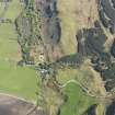
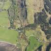
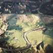
This oval fort, measuring 32.5m by 18m internally, occupies the summit of a rocky knoll which lies immediately NW of the standing stone noted on NM80SW 1 and about 400m SSE of Kintraw farmhouse. The wall has been reduced to a low band of rubble in which occasional outer facing-stones are visible on the S and E; small patches of vitrified stonework can be seen on the N and SSW, as well as fire-reddened stones elsewhere along the course of the wall. The position of the entrance is not clear, but it almost certainly lay on the N, where an outwork was built to enclose a small terrace. There is a low grassy scarp in the NW of the grass-grown interior, which may indicate the site of a timber building.
RCAHMS 1988, visited May 1982.
Field Visit (2003)
NM 83210 04831 Site included in a field survey carried out by GUARD in 2003. This dun is steep sided and the vegetation on the summit is grass and reeds. There is some evidence for rubble walls and outworks but there is no visible evidence for re-use in the form of stone-built structures.
HF James 2003 (RCAHMS MS/2371, no. 27).
Note (26 November 2014 - 18 May 2016)
This small fortification occupies the summit of a rocky knoll in the bend of the public road overlooking the cairns and standing stone at Kintraw. Oval on plan, it measures about 32m from NNE to SSW by 18m transversely (0.05ha) within a wall reduced largely to a low band of rubble; a few runs of the outer face can be seen on the E and S, and small patches of vitrifaction are exposed on the N and SSW. The entrance is not visible, but may have been protected by a small outwork that loops out from the line of the main wall to enclose a small terrace on the NNE. A low scarp on the NW side of the interior may indicate the back of the platform for a timber round-house.
Information from An Atlas of Hillforts of Great Britain and Ireland – 18 May 2016. Atlas of Hillforts SC2557


