
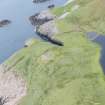
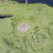
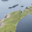
Broch Of Culswick


Farmstead (Period Unassigned)
Site Name Broch Of Culswick
Classification Farmstead (Period Unassigned)
Canmore ID 227677
Site Number HU24SE 51
NGR HU 25445 44822
Datum OSGB36 - NGR
Permalink http://canmore.org.uk/site/227677


- Council Shetland Islands
- Parish Sandsting
- Former Region Shetland Islands Area
- Former District Shetland
- Former County Shetland
HU24SE 51 25445 44822
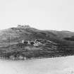
One roofed building is depicted on the 1st edition of the OS 6-inch map (Orkney & Shetland (Shetland) 1882, sheet li), but by the time of the 2nd edition is shown unroofed. One unroofed building with an enclosure is depicted on the current edition of the OS 1:10000 map (1980).
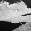
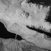
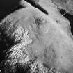
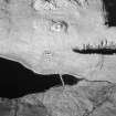
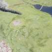
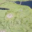
The farmstead is visible on oblique aerial photographs taken in 1983 by Professor D W Harding which show two unroofed buildings with a D-shaped enclosure to the N. Two other structures are visible to the E. Also visible on the photographs is a small system of field banks.
Information from RCAHMS (DE) 20 November 2002

