
Mull, Auchnacraig Bridge


Road Bridge (18th Century)
Site Name Mull, Auchnacraig Bridge
Classification Road Bridge (18th Century)
Alternative Name(s) Lochdonhead Bridge;
Canmore ID 22670
Site Number NM73SW 5
NGR NM 72758 32834
Datum OSGB36 - NGR
Permalink http://canmore.org.uk/site/22670


- Council Argyll And Bute
- Parish Torosay
- Former Region Strathclyde
- Former District Argyll And Bute
- Former County Argyll
Field Visit (May 1974)
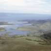
This bridge spans the uppermost reach of Loch Don about 5km SE of Craignure. It is a plain segmental-arched structure of rubble with slab voussoirs, the span being 10.7 m and the height of the arch above the water 3.8 m. The roadway has a width of 3.7 m within parapets 0.4 m in thickness. The bridge was probably built about 1790, when the road from Grass point to Aros was constructed at the instigation of the 5th Duke of Argyll; it bears close resemblance to the old bridge at Aros which was erected at about the same time (2).
RCAHMS 1980, visited 1974.
(2) Stat. Acct., iii (1792), 268; Cregeen, Estate Instructions, 158.

