Mull, Mingary, Dun Ban
Fort (Period Unassigned)
Site Name Mull, Mingary, Dun Ban
Classification Fort (Period Unassigned)
Alternative Name(s) Quinish Point
Canmore ID 22080
Site Number NM45NW 4
NGR NM 4084 5663
Datum OSGB36 - NGR
Permalink http://canmore.org.uk/site/22080
- Council Argyll And Bute
- Parish Kilninian And Kilmore
- Former Region Strathclyde
- Former District Argyll And Bute
- Former County Argyll
NM45NW 4 4084 5663.
(NM 4084 5663) Dun Ban (NAT) Fort (NR)
OS 1:10000 map (1976)
Fort, Dun Ban: This fort occupies the summit of a conspicuous rocky plateau, which is situated on the sea-shore about 400m SSW of Quinish Point. Access to the summit may be obtained across a narrow col on the E, but an all other sides the plateau is protected by steep or precipitous rock-faces varying between 7m and 13m in height. The fort is irregular on plan and measures 58m by 32m internally. It has been defended by a boulder-faced rubble-cored wall, which is now in a severely denuded condition, surviving for the most part as a mere spread of core material. On the S and SE, however, several stretches of outer facing-stones and one short length of the inner face have been preserved in situ, indicating that the original thickness was about 3m. The position of the entrance is marked by a gap in the wall-debris, about 3.2m wide, situated opposite the col on the SE, but a larger gap on the SW has presumably resulted from a collapse of the cliff-face. Apart from a ruined marker-cairn of no great age, the interior is featureless.
The gully flanking the plateau on the NE is blocked near its mid-point by a mass of boulders, but whether they are tumbled remains of an outer line of defence or merely a fortuitous accumulation of boulders from the storm-beach and debris from the wall of the fort above cannot be ascertained without excavation. The various lengths of ruined walling that can be seen on the edge of natural crests to the S and E of the fort appear to be of comparatively recent origin.
RCAHMS 1980, visited 1972
Dun Ban, a fort - surveyed at 1:10,000.
Visited by OS (DWR) 24 April 1972
Field Visit (8 June 1934)
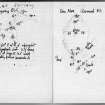
Visited by VG Childe. Notes held in MS 36 and typescript filed with Emergency Survey material.
Field Visit (1 July 1943)
This site was included within the RCAHMS Emergency Survey (1942-3), an unpublished rescue project. Site descriptions, organised by county, vary from short notes to lengthy and full descriptions and are available to view online with contemporary sketches and photographs. The original typescripts, manuscripts, notebooks and photographs can also be consulted in the RCAHMS Search Room.
Information from RCAHMS (GFG) 10 December 2014.
Note (11 November 2014 - 15 August 2016)
This fortification is situated on a flat-topped hillock on the coast to the S of Quinish Pint, exploiting a position girt with cliffs and steep rocky slopes up to 13m high. The only access is across a narrow col on the E, which leads up to the entrance through the stone wall that extends around the margin of the summit. Severely denuded, a two stretches of outer face and one of inner are visible on the S, indicating an original thickness of about 3m. The interior, which is irregular on plan and measures 58m from ENE to WSW by 32m transversely (0.11ha), is featureless apart from a ruined marker cairn.
Information from An Atlas of Hillforts of Great Britain and Ireland – 15 August 2016. Atlas of Hillforts SC2516


