Scheduled Maintenance
Please be advised that this website will undergo scheduled maintenance on the following dates: •
Tuesday 3rd December 11:00-15:00
During these times, some services may be temporarily unavailable. We apologise for any inconvenience this may cause.
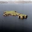
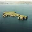
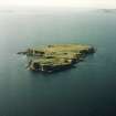
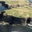
Staffa
Cultivation Remains (Period Unassigned), Enclosure (Period Unassigned), Structure(S) (Period Unassigned)
Site Name Staffa
Classification Cultivation Remains (Period Unassigned), Enclosure (Period Unassigned), Structure(S) (Period Unassigned)
Alternative Name(s) Mckinnon's Cave
Canmore ID 21784
Site Number NM33NW 3
NGR NM 32449 35447
Datum OSGB36 - NGR
Permalink http://canmore.org.uk/site/21784
- Council Argyll And Bute
- Parish Kilninian And Kilmore
- Former Region Strathclyde
- Former District Argyll And Bute
- Former County Argyll
NM33NW 3 3243 3545
(NM 3243 3544) The only sign of habitation on Staffa is a pile of ruins, which still retains a comparatively well-built Gothic arched window. The ruins are 31' x 13' internally. The highest part of the 18" thick walls c. 8' high. The arched window is 4'6" from sill to apex, by 2'6", having a 6" splay in the wall. The back window is 4'6" x 2', also splayed. There is a 3' x 3'7" splayed recess, with a lintel, in the E gable, apparently a fireplace. The walls of the ruins are of well-squared blocks of basalt bonded by shell-mortar, and a central rubble core. The threshold stone is of sandstone, probably from Mull, as there is no sandstone on Staffa. The ruins have been compared to St Oran's Chapel on Iona, but the architecture is very crude. From a photograph, the ruins have been considered by the Society for the Preservation of Ancient Monuments to be the remains of a chapel, probably of 13th-14th century date. However, MacCulloch (1934) concludes that, from the fact that earlier accounts make no mention of a pointed arch window on any building on Staffa, and from enquiries, that this building was partly erected, but never completed, by the proprietor of Staffa, who intended it to be a hostel for visitors, and dates from c. 1815.
A few yards W of these ruins are the remains of what was probably a small dwelling-house, or perhaps a monastic cell. The low fragments of wall remaining have the stones built together in a workmanlike manner, though the blocks are unhewn and there is no mortar.
D MacCulloch 1934
Cottage, Staffa: The small ruined structure on the summit plateau of Staffa, some 320m NNW of the boat-landing at Clamshell Cave, is a shelter built in the Gothic style in the early 19th century for visitors to the island. It stands close to an area of former rig-cultivation, probably associated with the intermittent occupation of the island recorded in the last quarter of the 18th century. The ruins of an outhouse, probably dating from the latter period, and a freshwater spring, are situated short distances to the WNW and SW respectively. The building was evidently erected by Ranald MacDonald of Boisdale, and was perhaps left incomplete when financial difficulties compelled him to dispose of the island in 1816. It has deteriorated in recent years, the walls now standing to a maximum height of about 2m. The building measures 10.4m by 4.9m over 0.5m walls and was probably intended to be only one storey in height, containing two rooms. The masonry is of lime-mortared rubble. In the SE wall were two arch-pointed windows framed within shallow recesses extending to ground level. The door-head and one of these windows were destroyed before 1922, and the head of the remaining window has collapsed in recent years.
RCAHMS 1980, visited 1973
NM 32 35 AOC (Scotland) Ltd was commissioned to undertake an archaeological survey of the lands controlled by the National Trust for Scotland on Staffa. The survey took place in late May and early April of 1996. Recorded sites are listed below. The full report of this survey has been deposited with both the local SMR and the NMRS.
McKinnon's Cave:
NM 3244 3546 Settlement and enclosures.
Sponsor: National Trust for Scotland
T Rees 1996
Two unroofed buildings are depicted on the 1st edition of the OS 6-inch map (Argyllshire, Island of Staffa etc. 1881, sheet xciii) and on the current edition of the OS 1:10000 map (1975).
Information from RCAHMS (SAH) 21 July 1998.
Ground Survey (3 June 2010)
NM 3243 3545 As part of a National Trust for Scotland Thistle Camp volunteers undertook a survey of the remains of the structure on Staffa, using photography, an EDM and a plane table. This survey was carried out on 3 June 2010.
Archive: RCAHMS (intended)
Funder: The National Trust for Scotland
Derek Alexander – The National Trust for Scotland
Project (2014 - 2017)
NM 3243 3545 (NM33NW 3) As part of a multi-disciplinary project over a number of years, survey and excavation work has been carried out at the site of the ruinous stone bothy in the centre of the island of Staffa.
In 2014 a series of ten test pits were excavated. Four were located around the bothy structure (NM33NW 3), two on the plateau to the N, one overlooking the E coast and another three on the slopes of Meal nan Gamhna, which forms the southern end of the island. Of these only Test Pit 1 in the kale yard NE of the bothy and Test Pit 2 to the W of the bothy located any significant archaeological deposits. Test Pit 1 produced a burnt deposit of oats which was radiocarbon dated to the mid-15th to early 17th century AD. A sherd of coarse ware pottery and three pieces of flint were also recovered. Test Pit 2 located the line of a turf and stone wall aligned SW/NE which may have formed the eastern side of a structure. Five 20 x 20m grids of geophysical survey were undertaken to the S and E of the concentration of structures. Topographic survey of this area was also completed using a combination of laser scanning and drone photography.
In 2016 work focused on three trenches (Tr 1–3) outside and around the bothy structure to the SE, NW, SW, respectively. Trench 1 measured 3 x 2m and located a pit at least 1m across and 0.3m deep that contained charcoal and burnt pottery. A single sherd of pottery was decorated
with incised lines and could be a piece of Neolithic Hebridean ware. Trench 2, to the NW, measured 2 x 1m wide and was only 0.2m deep down onto fragmented bedrock in clay. Trench 3, to the SW, measured 1 x 1m, and quickly came down on to bedrock in the form of the tops of hexagonal basalt columns.
In 2017 two trenches were excavated within the interior of the ruined bothy at a time of year when there were no nesting birds. Trench 1 was 5m long by 1m wide and located in the SW corner. The wall was sitting on a rough
rubble foundation. A spread of clay may have marked the floor level but there few 19th-century finds. Towards the middle of the structure a steep sided cut look either like a drain or a construction slot. Under the floor surface an earlier, possibly agricultural soil contained pieces of flint and some coarse ware pottery. The other trench, Trench 2 was a 1m test pit in the SE corner. Two further test pits were excavated in the area of rig to the S of the bothy.
Archive: NRHE (intended)
Funder: National Trust for Scotland, NTS London Members Centre and Society of Antiquaries of Scotland
Unspecified Geophysical Survey Technique (2014)
NM 3243 3545 (NM33NW 3) Geophysical survey.
Archive: NRHE (intended)
Funder: National Trust for Scotland, NTS London Members Centre and Society of Antiquaries of Scotland
Excavation (23 July 2018 - 29 July 2018)
NM 3243 3545 As part of a multi-disciplinary project over
a number of years, survey and excavation work has been
carried out at the site of the ruinous stone bothy in the centre
of the island of Staffa.
This season, 23–29 July 2018, we returned to the trench
which we had excavated in 2016 in front of the bothy. A recent
radiocarbon date from the 2016 samples suggested that there
was a feature dating to the Middle Bronze Age. The previous
trench was therefore extended from 3m long by 2m wide to
4m by 5m. Within this trench, under 0.4m thick deposit of
topsoil, there was part of a small ring ditched feature, 0.6m
wide by 0.3m deep, which was at least 3m in diameter. Finds
from the excavation included a range of sherds of prehistoric
pottery, some decorated with incised and impressed designs,
including chevron and diagonal patterns. Assemblages of
chipped stone and coarse stone tools were also recovered.
Archive: NRHE (intended)
Funder: The National Trust for Scotland, NTS London Members
Centre and the Society of Antiquaries of Scotland
Derek Alexander, Daniel Rhodes, Stuart Jeffrey, Sian Jones and
Tessa Poller – The National Trust for Scotland, Glasgow School
of Art, University of Stirling and University of Glasgow
(Source: DES, Volume 19)
Project (2019)
NM 3243 3545 As part of a multi-disciplinary project over a number of years, survey and excavation work has been carried out at the site of the ruinous stone bothy in the centre of the island of Staffa (DES 2017, 58; DES 2018, 45; Canmore ID: 21784).
In 2019 measured survey was undertaken of the area around the ruined bothy (NM 32447 35452). The remains of three structures are located in an arc to the north. Structure 1 (NM 32466 35455) lies 15m north-east of the bothy. It measures 11m long, NW to SE, by c. 5m wide and is divided into two parts. The SE compartment is 4.7m long by 3.3m wide and has an entrance, 1.3m wide, in its SW side. The NW compartment is 4.1m long by 3.7m wide, and also has an entrance, c. 1m wide, in the south-western side. This NW compartment sits on a slope, lower than the other, and is probably a later addition.
A low earth and stone bank, 1.4m wide by 0.5m high, forms a D-shaped kailyard enclosure (NM 32472 35459) abutted onto the north-eastern side of Structure 1. This enclosure measures 15m long by 9m wide.
Structure 2 (NM 32455 35468) is located c.12m north of the northern corner of the bothy. It measures c.9.7m long, east to west, by c.5.4m wide. Structure 3 (NM 32427 35452) is located c.13m west of the bothy. It measures 4.8m long, NW to SE by 6.1m wide. It is likely that this forms the NW gable end of a building that originally extended further to the SE. This was confirmed by a test pit excavated in 2014. It is likely that all three of these structures were robbed for their stone during the construction of the bothy at the start of the 19th century.
In addition, two small quarry scoops were recorded. Quarry 1 (NM 32438 35465) is located c.14m to the north-west of the bothy between structures 2 and 3. Quarry 2 (NM 32442 35435) is located c.11m to the south-west of the bothy.
Excavation work in 2019 included the opening of 5 trenches. A linear trench (Tr 19.1) 4m long, SW to NE, by 1m wide, was positioned across the SE wall of Structure 1, from the inside of the structure, across the wall and into the kailyard beyond. A second linear trench (Tr 19.2) 4m long, SW to NE, by 1m wide, was positioned across the south-eastern bank of the kailyard enclosure abutted to Structure 1.
Five 20 x 20m geophysics grids were laid out in the area to the south of the bothy. Survey work was undertaken using both resistivity and magnetometry.
Three 1 x 1m test pits (Tr 19.3 – Tr 19.5) were excavated in the open ground to the south of the bothy. These were positioned to examine geophysical anomalies and also to determine how far any prehistoric material, found during 2016 and 2018, extended to the south.
Archive: NRHE (intended)
Funder: The National Trust for Scotland, NTS London Members Centre and Society of Antiquaries of Scotland
Derek Alexander, Daniel Rhodes, Stuart Jeffrey, Sian Jones, Tessa Poller - The National Trust for Scotland, Glasgow School of Art, University of Stirling, University of Glasgow
(Source: DES Vol 20)
Resistivity (2019)
NM 3243 3545 Resistivity survey.
Archive: NRHE (intended)
Funder: The National Trust for Scotland, NTS London Members Centre and Society of Antiquaries of Scotland
Derek Alexander, Daniel Rhodes, Stuart Jeffrey, Sian Jones, Tessa Poller - The National Trust for Scotland, Glasgow School of Art, University of Stirling, University of Glasgow
(Source: DES Vol 20)
Magnetometry (2019)
NM 3243 3545 Magnetometry survey.
Archive: NRHE (intended)
Funder: The National Trust for Scotland, NTS London Members Centre and Society of Antiquaries of Scotland
Derek Alexander, Daniel Rhodes, Stuart Jeffrey, Sian Jones, Tessa Poller - The National Trust for Scotland, Glasgow School of Art, University of Stirling, University of Glasgow
(Source: DES Vol 20)


