
Low Drumrae


Farmstead (Period Unassigned)
Site Name Low Drumrae
Classification Farmstead (Period Unassigned)
Canmore ID 216689
Site Number NX44SW 92
NGR NX 40312 42305
Datum OSGB36 - NGR
Permalink http://canmore.org.uk/site/216689


- Council Dumfries And Galloway
- Parish Glasserton
- Former Region Dumfries And Galloway
- Former District Wigtown
- Former County Wigtownshire
NX44SW 92 40312 42305.
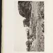
This site was visited as part of the RCAHMS Scottish Farm Buildings Survey on 22 September 1993. The farmstead comprises a complex of buildings.
Information from RCAHMS (ACD) 28 January 2008; NMRS MS 2560/290

