
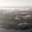
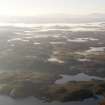
Lewis, Loch Buaile Bhig


Head Dyke (Post Medieval)(Possible)
Site Name Lewis, Loch Buaile Bhig
Classification Head Dyke (Post Medieval)(Possible)
Canmore ID 206869
Site Number NB42NW 6
NGR NB 423 291
NGR Description Centred on NB 423 291
Datum OSGB36 - NGR
Permalink http://canmore.org.uk/site/206869


- Council Western Isles
- Parish Lochs
- Former Region Western Isles Islands Area
- Former District Western Isles
- Former County Ross And Cromarty
Note
What may be a head-dyke approximately 300m in length, which is annotated Old Fence, is depicted on the 1st edition of the OS 6-inch map (Island of Lewis, Ross-shire 1854, sheet 27), but it is not shown on the current edition of the OS 1:10000 map (1973).
Information from RCAHMS (SAH) 28 January 2002

