
Aberdeen, 2-12 Rennie's Wynd, Littlewood's Extension


Building(S) (Period Unassigned), Natural Feature(S) (Period Unknown)
Site Name Aberdeen, 2-12 Rennie's Wynd, Littlewood's Extension
Classification Building(S) (Period Unassigned), Natural Feature(S) (Period Unknown)
Alternative Name(s) E3
Canmore ID 20014
Site Number NJ90NW 114
NGR NJ 9406 0606
Datum OSGB36 - NGR
Permalink http://canmore.org.uk/site/20014


- Council Aberdeen, City Of
- Parish Aberdeen
- Former Region Grampian
- Former District City Of Aberdeen
- Former County Aberdeenshire
NJ90NW 114 9406 0606.
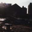
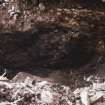
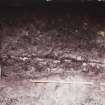
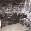
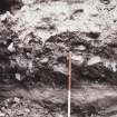
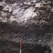
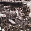
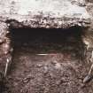
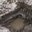
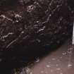
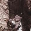
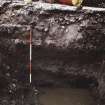
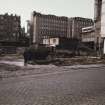
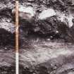
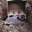
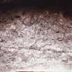
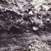
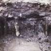
This site was observed during demolition prior to the construction of Littlewoods extension. Medieval occupation would have been impossible as the presence of water-laid deposits showed that the area would have been estuarine, and that it was possible that this was the site of an earlier bed of the Denburn. Excavations at 67-71 Green (NJ90NW 113) revealed the same waterlaid deposits at a slightly higher level overlaid by some medieval garden earth suggesting that the higher N margin of the estuary was being reclaimed by c.13th century. There was no comparable evidence at this site and it appears likely to have remained waterlogged until a later period; it is shown as garden ground with a few buildings on Parson Gordon's map of 1661. No artefacts were recovered from the site.
C Murray 1977; J C Murray 1982.
The archive from 2-12 Rennie's Wynd has been catalogued. It consists of colour photographs (prints only) and manuscripts.
Historic Scotland Archive Project (FO) 1997.

