
The Slacks


Clearance Cairn(S) (Period Unassigned), Hut Circle (Prehistoric), Rig And Furrow (Medieval) - (Post Medieval)
Site Name The Slacks
Classification Clearance Cairn(S) (Period Unassigned), Hut Circle (Prehistoric), Rig And Furrow (Medieval) - (Post Medieval)
Alternative Name(s) Blue Hill
Canmore ID 19587
Site Number NJ81SW 48
NGR NJ 841 144
Datum OSGB36 - NGR
Permalink http://canmore.org.uk/site/19587


- Council Aberdeen, City Of
- Parish Dyce
- Former Region Grampian
- Former District City Of Aberdeen
- Former County Aberdeenshire
NJ81SW 48 841 144.
A hut circle lies 20m SE of cairn NJ81SW 21. It measures 10m in diameter, walls up to 0.6m high, and there is marked hollowing of the interior. It has been damaged along its N-S axis by ploughing prior to afforestation some 30 years ago. A plane table survey of the site was prepared and is lodged in the Anthropological Museum, University of Aberdeen, where a number of surface finds from the area are also housed.
J Inglis and J Hay 1984.
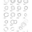
(Location cited as NJ 846 145). Blue Hill. Air photography (AAS/82/2/S3/19-26) has recorded two circular stone-walled enclosures( one of them possibly a hut-circle and the other larger) amidst a complex of rig-and-furrow cultivation at the foot of a moderate SW-facing slope at an altitude of between 150 and 180m OD.
NMRS, MS/712/36.
Site recorded from draft text of Discovery and Excavation in Scotland 1997 (ref 97/467), held by Council for Scottish Archaeology.
CSA 1997.
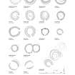
(Formerly classified as Hut-circle; Rig; Field Clearance Cairns: classification amended to Hut-Circles; Small Cairns; Rig). The remains of two hut-circles and an extensive scatter of small cairns are situated on this prominent hill, the E side of which is called Blue Hill and the W side The Slacks. Whereas Blue Hill is currently given over to rough pasture, The Slacks is presently occupied by a Forestry Commission plantation. Within the scatter of cairns, the largest of which are about 5m in diameter, there is also a large burial cairn (NJ81SW 21). This is set on a false crest on the W flank of the hill and would have been a prominent feature from the valley to the W before the trees were planted. The first hut-circle (NJ 8419 1442) is situated immediately to the SE of the burial cairn and measures about 8.5m in diameter within a grass-grown bank up to 1.8m in thickness and 0.5m in height. The W side of the hut-circle has been heavily disturbed and the position of the entrance cannot be identified with any confidence. The second hut-circle (NJ 8431 1420) is situated higher up the slope and was partly obscured by a large fallen tree on the date of visit. It measures about 10m in diameter within a grass-grown stony bank up to 2m in thickness and 0.5m in height, and the entrance is on the E.
Visited by RCAHMS (JRS, ATW), 21 March 1997.

