
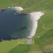
Unst, Vinstrick


Farmstead (Period Unassigned)
Site Name Unst, Vinstrick
Classification Farmstead (Period Unassigned)
Canmore ID 188691
Site Number HP50SE 68
NGR HP 5733 0394
Datum OSGB36 - NGR
Permalink http://canmore.org.uk/site/188691


- Council Shetland Islands
- Parish Unst
- Former Region Shetland Islands Area
- Former District Shetland
- Former County Shetland
HP50SE 68 5733 0394
A farmstead comprising one unroofed building of three compartments, one unroofed structure and one enclosure is depicted on the 1st edition of the OS 6-inch map (Orkney and Shetland (Shetland) 1881, sheet viii). One unroofed building is shown on the current edition of the OS 1:10000 map (1973).
Information from RCAHMS (SAH) 6 February 2001
Field Visit (January 1970 - December 1991)
A survey of deserted settlements in Unst by June Owers. The survey includes photographs, sketches and historical information.
Srp Note (27 September 2011)
A plan of this farmstead was drawn by June Owers in her survey of deserted settlements in Unst (1976). It depicts a farmstead of three buildings, comprising a former croft house, a parallel byre and a third structure set perpendicular to the dwelling.
Information from RCAHMS (BRW) 26 September 2011

