
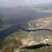
Inverness, Caledonian Canal, Branch Railway, Muirtown Basin


Railway (19th Century) - (20th Century)
Site Name Inverness, Caledonian Canal, Branch Railway, Muirtown Basin
Classification Railway (19th Century) - (20th Century)
Canmore ID 187793
Site Number NH64NE 120.02
NGR NH 6519 4657
NGR Description NH 6541 4666 to NH 6544 4597
Datum OSGB36 - NGR
Permalink http://canmore.org.uk/site/187793


- Council Highland
- Parish Inverness And Bona
- Former Region Highland
- Former District Inverness
- Former County Inverness-shire
NH64NE 120.02 6541 4666 to 6544 4597
This branch line to the canal is clearly marked on the 2nd edition of the OS 6-inch map (Inverness-shire 1907, sheet iv) and the track is still visible on the current edition of the 1:10000 map (1992) and on the OS Basic Scale raster map (ND).
Information from RCAHMS (MD), 3 October 2001.

