
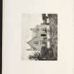
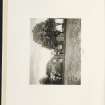
Brandsbutt


Farmstead (Period Unassigned)
Site Name Brandsbutt
Classification Farmstead (Period Unassigned)
Canmore ID 186718
Site Number NJ72SE 283
NGR NJ 7605 2246
Datum OSGB36 - NGR
Permalink http://canmore.org.uk/site/186718
Ordnance Survey licence number AC0000807262. All rights reserved.
Canmore Disclaimer.
© Copyright and database right 2024.
- Correction
- Favourite

SC 2157639
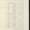
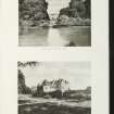
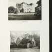
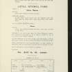
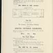
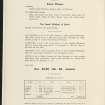
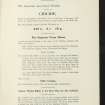
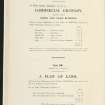
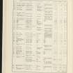
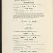
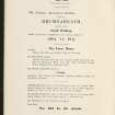
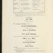
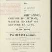
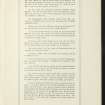
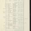
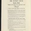
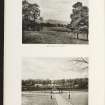
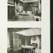
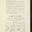
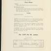
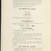
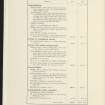
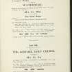
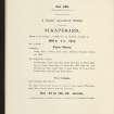
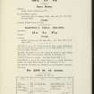
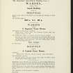
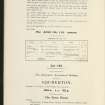
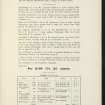
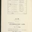
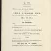
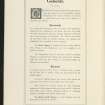
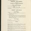
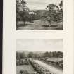
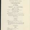
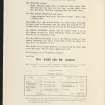
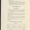
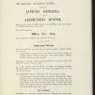
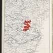
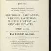
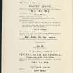
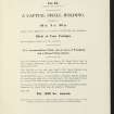
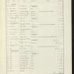
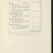
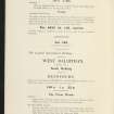
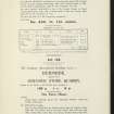
Estate Exchange. Keithhall, Ardtannes, Crichie, Balbithan, Wester Fintray, Kintore. No 1472. Sale Brochure
Collection of sale catalogues relating to Scottish estates
6/8/1914
© Courtesy of HES (Estates Exchange collection)

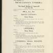
SC 2157647
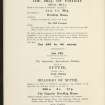
Estate Exchange. Keithhall, Ardtannes, Crichie, Balbithan, Wester Fintray, Kintore. No 1472. Sale Brochure
Collection of sale catalogues relating to Scottish estates
6/8/1914
© Courtesy of HES (Estates Exchange collection)

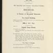
SC 2157649
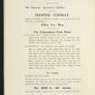
Estate Exchange. Keithhall, Ardtannes, Crichie, Balbithan, Wester Fintray, Kintore. No 1472. Sale Brochure
Collection of sale catalogues relating to Scottish estates
6/8/1914
© Courtesy of HES (Estates Exchange collection)

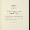
SC 2157655
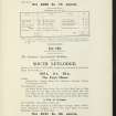
Estate Exchange. Keithhall, Ardtannes, Crichie, Balbithan, Wester Fintray, Kintore. No 1472. Sale Brochure
Collection of sale catalogues relating to Scottish estates
6/8/1914
© Courtesy of HES (Estates Exchange collection)

SC 2157656
Estate Exchange. Keithhall, Ardtannes, Crichie, Balbithan, Wester Fintray, Kintore. No 1472. Sale Brochure
Collection of sale catalogues relating to Scottish estates
6/8/1914
© Courtesy of HES (Estates Exchange collection)

SC 2157657
Estate Exchange. Keithhall, Ardtannes, Crichie, Balbithan, Wester Fintray, Kintore. No 1472. Sale Brochure
Collection of sale catalogues relating to Scottish estates
6/8/1914
© Courtesy of HES (Estates Exchange collection)

SC 2157661
Estate Exchange. Keithhall, Ardtannes, Crichie, Balbithan, Wester Fintray, Kintore. No 1472. Sale Brochure
Collection of sale catalogues relating to Scottish estates
6/8/1914
© Courtesy of HES (Estates Exchange collection)

SC 2157667
Estate Exchange. Keithhall, Ardtannes, Crichie, Balbithan, Wester Fintray, Kintore. No 1472. Sale Brochure
Collection of sale catalogues relating to Scottish estates
6/8/1914
© Courtesy of HES (Estates Exchange collection)

SC 2157675
Estate Exchange. Keithhall, Ardtannes, Crichie, Balbithan, Wester Fintray, Kintore. No 1472. Sale Brochure
Collection of sale catalogues relating to Scottish estates
6/8/1914
© Courtesy of HES (Estates Exchange collection)

SC 2157680
Estate Exchange. Keithhall, Ardtannes, Crichie, Balbithan, Wester Fintray, Kintore. No 1472. Sale Brochure
Collection of sale catalogues relating to Scottish estates
6/8/1914
© Courtesy of HES (Estates Exchange collection)

SC 2157688
Estate Exchange. Keithhall, Ardtannes, Crichie, Balbithan, Wester Fintray, Kintore. No 1472. Sale Brochure
Collection of sale catalogues relating to Scottish estates
6/8/1914
© Courtesy of HES (Estates Exchange collection)

SC 2157699
Estate Exchange. Keithhall, Ardtannes, Crichie, Balbithan, Wester Fintray, Kintore. No 1472. Sale Brochure
Collection of sale catalogues relating to Scottish estates
6/8/1914
© Courtesy of HES (Estates Exchange collection)

SC 2157712
Estate Exchange. Keithhall, Ardtannes, Crichie, Balbithan, Wester Fintray, Kintore. No 1472. Sale Brochure
Collection of sale catalogues relating to Scottish estates
6/8/1914
© Courtesy of HES (Estates Exchange collection)

SC 2157714
Estate Exchange. Keithhall, Ardtannes, Crichie, Balbithan, Wester Fintray, Kintore. No 1472. Sale Brochure
Collection of sale catalogues relating to Scottish estates
6/8/1914
© Courtesy of HES (Estates Exchange collection)

SC 2157724
Estate Exchange. Keithhall, Ardtannes, Crichie, Balbithan, Wester Fintray, Kintore. No 1472. Sale Brochure
Collection of sale catalogues relating to Scottish estates
6/8/1914
© Courtesy of HES (Estates Exchange collection)

SC 2157733
Estate Exchange. Keithhall, Ardtannes, Crichie, Balbithan, Wester Fintray, Kintore. No 1472. Sale Brochure
Collection of sale catalogues relating to Scottish estates
6/8/1914
© Courtesy of HES (Estates Exchange collection)

SC 2157762
Estate Exchange. Keithhall, Ardtannes, Crichie, Balbithan, Wester Fintray, Kintore. No 1472. Sale Brochure
Collection of sale catalogues relating to Scottish estates
6/8/1914
© Courtesy of HES (Estates Exchange collection)

SC 2157628
Estate Exchange. Keithhall, Ardtannes, Crichie, Balbithan, Wester Fintray, Kintore. No 1472. Sale Brochure
Collection of sale catalogues relating to Scottish estates
6/8/1914
© Courtesy of HES (Estates Exchange collection)

SC 2157636
Estate Exchange. Keithhall, Ardtannes, Crichie, Balbithan, Wester Fintray, Kintore. No 1472. Sale Brochure
Collection of sale catalogues relating to Scottish estates
6/8/1914
© Courtesy of HES (Estates Exchange collection)

SC 2157637
Estate Exchange. Keithhall, Ardtannes, Crichie, Balbithan, Wester Fintray, Kintore. No 1472. Sale Brochure
Collection of sale catalogues relating to Scottish estates
6/8/1914
© Courtesy of HES (Estates Exchange collection)

SC 2157643
Estate Exchange. Keithhall, Ardtannes, Crichie, Balbithan, Wester Fintray, Kintore. No 1472. Sale Brochure
Collection of sale catalogues relating to Scottish estates
6/8/1914
© Courtesy of HES (Estates Exchange collection)

SC 2157646
Estate Exchange. Keithhall, Ardtannes, Crichie, Balbithan, Wester Fintray, Kintore. No 1472. Sale Brochure
Collection of sale catalogues relating to Scottish estates
6/8/1914
© Courtesy of HES (Estates Exchange collection)

SC 2157648
Estate Exchange. Keithhall, Ardtannes, Crichie, Balbithan, Wester Fintray, Kintore. No 1472. Sale Brochure
Collection of sale catalogues relating to Scottish estates
6/8/1914
© Courtesy of HES (Estates Exchange collection)

SC 2157651
Estate Exchange. Keithhall, Ardtannes, Crichie, Balbithan, Wester Fintray, Kintore. No 1472. Sale Brochure
Collection of sale catalogues relating to Scottish estates
6/8/1914
© Courtesy of HES (Estates Exchange collection)

SC 2157653
Estate Exchange. Keithhall, Ardtannes, Crichie, Balbithan, Wester Fintray, Kintore. No 1472. Sale Brochure
Collection of sale catalogues relating to Scottish estates
6/8/1914
© Courtesy of HES (Estates Exchange collection)

SC 2157662
Estate Exchange. Keithhall, Ardtannes, Crichie, Balbithan, Wester Fintray, Kintore. No 1472. Sale Brochure
Collection of sale catalogues relating to Scottish estates
6/8/1914
© Courtesy of HES (Estates Exchange collection)

SC 2157664
Estate Exchange. Keithhall, Ardtannes, Crichie, Balbithan, Wester Fintray, Kintore. No 1472. Sale Brochure
Collection of sale catalogues relating to Scottish estates
6/8/1914
© Courtesy of HES (Estates Exchange collection)

SC 2157665
Estate Exchange. Keithhall, Ardtannes, Crichie, Balbithan, Wester Fintray, Kintore. No 1472. Sale Brochure
Collection of sale catalogues relating to Scottish estates
6/8/1914
© Courtesy of HES (Estates Exchange collection)

SC 2157666
Estate Exchange. Keithhall, Ardtannes, Crichie, Balbithan, Wester Fintray, Kintore. No 1472. Sale Brochure
Collection of sale catalogues relating to Scottish estates
6/8/1914
© Courtesy of HES (Estates Exchange collection)

SC 2157669
Estate Exchange. Keithhall, Ardtannes, Crichie, Balbithan, Wester Fintray, Kintore. No 1472. Sale Brochure
Collection of sale catalogues relating to Scottish estates
6/8/1914
© Courtesy of HES (Estates Exchange collection)

SC 2157671
Estate Exchange. Keithhall, Ardtannes, Crichie, Balbithan, Wester Fintray, Kintore. No 1472. Sale Brochure
Collection of sale catalogues relating to Scottish estates
6/8/1914
© Courtesy of HES (Estates Exchange collection)

SC 2157678
Estate Exchange. Keithhall, Ardtannes, Crichie, Balbithan, Wester Fintray, Kintore. No 1472. Sale Brochure
Collection of sale catalogues relating to Scottish estates
6/8/1914
© Courtesy of HES (Estates Exchange collection)

SC 2157682
Estate Exchange. Keithhall, Ardtannes, Crichie, Balbithan, Wester Fintray, Kintore. No 1472. Sale Brochure
Collection of sale catalogues relating to Scottish estates
6/8/1914
© Courtesy of HES (Estates Exchange collection)

SC 2157685
Estate Exchange. Keithhall, Ardtannes, Crichie, Balbithan, Wester Fintray, Kintore. No 1472. Sale Brochure
Collection of sale catalogues relating to Scottish estates
6/8/1914
© Courtesy of HES (Estates Exchange collection)

SC 2157690
Estate Exchange. Keithhall, Ardtannes, Crichie, Balbithan, Wester Fintray, Kintore. No 1472. Sale Brochure
Collection of sale catalogues relating to Scottish estates
6/8/1914
© Courtesy of HES (Estates Exchange collection)

SC 2157696
Estate Exchange. Keithhall, Ardtannes, Crichie, Balbithan, Wester Fintray, Kintore. No 1472. Sale Brochure
Collection of sale catalogues relating to Scottish estates
6/8/1914
© Courtesy of HES (Estates Exchange collection)

SC 2157718
Estate Exchange. Keithhall, Ardtannes, Crichie, Balbithan, Wester Fintray, Kintore. No 1472. Sale Brochure
Collection of sale catalogues relating to Scottish estates
6/8/1914
© Courtesy of HES (Estates Exchange collection)

SC 2157731
Estate Exchange. Keithhall, Ardtannes, Crichie, Balbithan, Wester Fintray, Kintore. No 1472. Sale Brochure
Collection of sale catalogues relating to Scottish estates
6/8/1914
© Courtesy of HES (Estates Exchange collection)

SC 2157732
Estate Exchange. Keithhall, Ardtannes, Crichie, Balbithan, Wester Fintray, Kintore. No 1472. Sale Brochure
Collection of sale catalogues relating to Scottish estates
6/8/1914
© Courtesy of HES (Estates Exchange collection)

SC 2157736
Estate Exchange. Keithhall, Ardtannes, Crichie, Balbithan, Wester Fintray, Kintore. No 1472. Sale Brochure
Collection of sale catalogues relating to Scottish estates
6/8/1914
© Courtesy of HES (Estates Exchange collection)

SC 2157737
Estate Exchange. Keithhall, Ardtannes, Crichie, Balbithan, Wester Fintray, Kintore. No 1472. Sale Brochure
Collection of sale catalogues relating to Scottish estates
6/8/1914
© Courtesy of HES (Estates Exchange collection)

SC 2157742
Estate Exchange. Keithhall, Ardtannes, Crichie, Balbithan, Wester Fintray, Kintore. No 1472. Sale Brochure
Collection of sale catalogues relating to Scottish estates
6/8/1914
© Courtesy of HES (Estates Exchange collection)

SC 2157755
Estate Exchange. Keithhall, Ardtannes, Crichie, Balbithan, Wester Fintray, Kintore. No 1472. Sale Brochure
Collection of sale catalogues relating to Scottish estates
6/8/1914
© Courtesy of HES (Estates Exchange collection)

SC 2157768
Estate Exchange. Keithhall, Ardtannes, Crichie, Balbithan, Wester Fintray, Kintore. No 1472. Sale Brochure
Collection of sale catalogues relating to Scottish estates
6/8/1914
© Courtesy of HES (Estates Exchange collection)

SC 2157770
Estate Exchange. Keithhall, Ardtannes, Crichie, Balbithan, Wester Fintray, Kintore. No 1472. Sale Brochure
Collection of sale catalogues relating to Scottish estates
6/8/1914
© Courtesy of HES (Estates Exchange collection)

SC 2157776
Estate Exchange. Keithhall, Ardtannes, Crichie, Balbithan, Wester Fintray, Kintore. No 1472. Sale Brochure
Collection of sale catalogues relating to Scottish estates
6/8/1914
© Courtesy of HES (Estates Exchange collection)

SC 2157787
Estate Exchange. Keithhall, Ardtannes, Crichie, Balbithan, Wester Fintray, Kintore. No 1472. Sale Brochure
Collection of sale catalogues relating to Scottish estates
6/8/1914
© Courtesy of HES (Estates Exchange collection)

SC 2157793
Estate Exchange. Keithhall, Ardtannes, Crichie, Balbithan, Wester Fintray, Kintore. No 1472. Sale Brochure
Collection of sale catalogues relating to Scottish estates
6/8/1914
© Courtesy of HES (Estates Exchange collection)

SC 2157632
Estate Exchange. Keithhall, Ardtannes, Crichie, Balbithan, Wester Fintray, Kintore. No 1472. Sale Brochure
Collection of sale catalogues relating to Scottish estates
6/8/1914
© Courtesy of HES (Estates Exchange collection)

SC 2157641
Estate Exchange. Keithhall, Ardtannes, Crichie, Balbithan, Wester Fintray, Kintore. No 1472. Sale Brochure
Collection of sale catalogues relating to Scottish estates
6/8/1914
© Courtesy of HES (Estates Exchange collection)

SC 2157679
Estate Exchange. Keithhall, Ardtannes, Crichie, Balbithan, Wester Fintray, Kintore. No 1472. Sale Brochure
Collection of sale catalogues relating to Scottish estates
6/8/1914
© Courtesy of HES (Estates Exchange collection)

SC 2157708
Estate Exchange. Keithhall, Ardtannes, Crichie, Balbithan, Wester Fintray, Kintore. No 1472. Sale Brochure
Collection of sale catalogues relating to Scottish estates
6/8/1914
© Courtesy of HES (Estates Exchange collection)

SC 2157729
Estate Exchange. Keithhall, Ardtannes, Crichie, Balbithan, Wester Fintray, Kintore. No 1472. Sale Brochure
Collection of sale catalogues relating to Scottish estates
6/8/1914
© Courtesy of HES (Estates Exchange collection)

SC 2157738
Estate Exchange. Keithhall, Ardtannes, Crichie, Balbithan, Wester Fintray, Kintore. No 1472. Sale Brochure
Collection of sale catalogues relating to Scottish estates
6/8/1914
© Courtesy of HES (Estates Exchange collection)

SC 2157744
Estate Exchange. Keithhall, Ardtannes, Crichie, Balbithan, Wester Fintray, Kintore. No 1472. Sale Brochure
Collection of sale catalogues relating to Scottish estates
6/8/1914
© Courtesy of HES (Estates Exchange collection)

SC 2157746
Estate Exchange. Keithhall, Ardtannes, Crichie, Balbithan, Wester Fintray, Kintore. No 1472. Sale Brochure
Collection of sale catalogues relating to Scottish estates
6/8/1914
© Courtesy of HES (Estates Exchange collection)

SC 2157753
Estate Exchange. Keithhall, Ardtannes, Crichie, Balbithan, Wester Fintray, Kintore. No 1472. Sale Brochure
Collection of sale catalogues relating to Scottish estates
6/8/1914
© Courtesy of HES (Estates Exchange collection)

SC 2157766
Estate Exchange. Keithhall, Ardtannes, Crichie, Balbithan, Wester Fintray, Kintore. No 1472. Sale Brochure
Collection of sale catalogues relating to Scottish estates
6/8/1914
© Courtesy of HES (Estates Exchange collection)

SC 2157771
Estate Exchange. Keithhall, Ardtannes, Crichie, Balbithan, Wester Fintray, Kintore. No 1472. Sale Brochure
Collection of sale catalogues relating to Scottish estates
6/8/1914
© Courtesy of HES (Estates Exchange collection)

SC 2157785
Estate Exchange. Keithhall, Ardtannes, Crichie, Balbithan, Wester Fintray, Kintore. No 1472. Sale Brochure
Collection of sale catalogues relating to Scottish estates
6/8/1914
© Courtesy of HES (Estates Exchange collection)

SC 2157789
Estate Exchange. Keithhall, Ardtannes, Crichie, Balbithan, Wester Fintray, Kintore. No 1472. Sale Brochure
Collection of sale catalogues relating to Scottish estates
6/8/1914
© Courtesy of HES (Estates Exchange collection)

SC 2157627
Estate Exchange. Keithhall, Ardtannes, Crichie, Balbithan, Wester Fintray, Kintore. No 1472. Sale Brochure
Collection of sale catalogues relating to Scottish estates
6/8/1914
© Courtesy of HES (Estates Exchange collection)

SC 2157630
Estate Exchange. Keithhall, Ardtannes, Crichie, Balbithan, Wester Fintray, Kintore. No 1472. Sale Brochure
Collection of sale catalogues relating to Scottish estates
6/8/1914
© Courtesy of HES (Estates Exchange collection)

SC 2157631
Estate Exchange. Keithhall, Ardtannes, Crichie, Balbithan, Wester Fintray, Kintore. No 1472. Sale Brochure
Collection of sale catalogues relating to Scottish estates
6/8/1914
© Courtesy of HES (Estates Exchange collection)

SC 2157635
Estate Exchange. Keithhall, Ardtannes, Crichie, Balbithan, Wester Fintray, Kintore. No 1472. Sale Brochure
Collection of sale catalogues relating to Scottish estates
6/8/1914
© Courtesy of HES (Estates Exchange collection)

SC 2157652
Estate Exchange. Keithhall, Ardtannes, Crichie, Balbithan, Wester Fintray, Kintore. No 1472. Sale Brochure
Collection of sale catalogues relating to Scottish estates
6/8/1914
© Courtesy of HES (Estates Exchange collection)

SC 2157668
Estate Exchange. Keithhall, Ardtannes, Crichie, Balbithan, Wester Fintray, Kintore. No 1472. Sale Brochure
Collection of sale catalogues relating to Scottish estates
6/8/1914
© Courtesy of HES (Estates Exchange collection)

SC 2157670
Estate Exchange. Keithhall, Ardtannes, Crichie, Balbithan, Wester Fintray, Kintore. No 1472. Sale Brochure
Collection of sale catalogues relating to Scottish estates
6/8/1914
© Courtesy of HES (Estates Exchange collection)

SC 2157672
Estate Exchange. Keithhall, Ardtannes, Crichie, Balbithan, Wester Fintray, Kintore. No 1472. Sale Brochure
Collection of sale catalogues relating to Scottish estates
6/8/1914
© Courtesy of HES (Estates Exchange collection)

SC 2157673
Estate Exchange. Keithhall, Ardtannes, Crichie, Balbithan, Wester Fintray, Kintore. No 1472. Sale Brochure
Collection of sale catalogues relating to Scottish estates
6/8/1914
© Courtesy of HES (Estates Exchange collection)

SC 2157689
Estate Exchange. Keithhall, Ardtannes, Crichie, Balbithan, Wester Fintray, Kintore. No 1472. Sale Brochure
Collection of sale catalogues relating to Scottish estates
6/8/1914
© Courtesy of HES (Estates Exchange collection)

SC 2157693
Estate Exchange. Keithhall, Ardtannes, Crichie, Balbithan, Wester Fintray, Kintore. No 1472. Sale Brochure
Collection of sale catalogues relating to Scottish estates
6/8/1914
© Courtesy of HES (Estates Exchange collection)

SC 2157704
Estate Exchange. Keithhall, Ardtannes, Crichie, Balbithan, Wester Fintray, Kintore. No 1472. Sale Brochure
Collection of sale catalogues relating to Scottish estates
6/8/1914
© Courtesy of HES (Estates Exchange collection)

SC 2157707
Estate Exchange. Keithhall, Ardtannes, Crichie, Balbithan, Wester Fintray, Kintore. No 1472. Sale Brochure
Collection of sale catalogues relating to Scottish estates
6/8/1914
© Courtesy of HES (Estates Exchange collection)

SC 2157709
Estate Exchange. Keithhall, Ardtannes, Crichie, Balbithan, Wester Fintray, Kintore. No 1472. Sale Brochure
Collection of sale catalogues relating to Scottish estates
6/8/1914
© Courtesy of HES (Estates Exchange collection)

SC 2157710
Estate Exchange. Keithhall, Ardtannes, Crichie, Balbithan, Wester Fintray, Kintore. No 1472. Sale Brochure
Collection of sale catalogues relating to Scottish estates
6/8/1914
© Courtesy of HES (Estates Exchange collection)

SC 2157720
Estate Exchange. Keithhall, Ardtannes, Crichie, Balbithan, Wester Fintray, Kintore. No 1472. Sale Brochure
Collection of sale catalogues relating to Scottish estates
6/8/1914
© Courtesy of HES (Estates Exchange collection)

SC 2157721
Estate Exchange. Keithhall, Ardtannes, Crichie, Balbithan, Wester Fintray, Kintore. No 1472. Sale Brochure
Collection of sale catalogues relating to Scottish estates
6/8/1914
© Courtesy of HES (Estates Exchange collection)

SC 2157726
Estate Exchange. Keithhall, Ardtannes, Crichie, Balbithan, Wester Fintray, Kintore. No 1472. Sale Brochure
Collection of sale catalogues relating to Scottish estates
6/8/1914
© Courtesy of HES (Estates Exchange collection)

SC 2157728
Estate Exchange. Keithhall, Ardtannes, Crichie, Balbithan, Wester Fintray, Kintore. No 1472. Sale Brochure
Collection of sale catalogues relating to Scottish estates
6/8/1914
© Courtesy of HES (Estates Exchange collection)

SC 2157739
Estate Exchange. Keithhall, Ardtannes, Crichie, Balbithan, Wester Fintray, Kintore. No 1472. Sale Brochure
Collection of sale catalogues relating to Scottish estates
6/8/1914
© Courtesy of HES (Estates Exchange collection)

SC 2157740
Estate Exchange. Keithhall, Ardtannes, Crichie, Balbithan, Wester Fintray, Kintore. No 1472. Sale Brochure
Collection of sale catalogues relating to Scottish estates
6/8/1914
© Courtesy of HES (Estates Exchange collection)

SC 2157754
Estate Exchange. Keithhall, Ardtannes, Crichie, Balbithan, Wester Fintray, Kintore. No 1472. Sale Brochure
Collection of sale catalogues relating to Scottish estates
6/8/1914
© Courtesy of HES (Estates Exchange collection)

SC 2157781
Estate Exchange. Keithhall, Ardtannes, Crichie, Balbithan, Wester Fintray, Kintore. No 1472. Sale Brochure
Collection of sale catalogues relating to Scottish estates
6/8/1914
© Courtesy of HES (Estates Exchange collection)

SC 2157788
Estate Exchange. Keithhall, Ardtannes, Crichie, Balbithan, Wester Fintray, Kintore. No 1472. Sale Brochure
Collection of sale catalogues relating to Scottish estates
6/8/1914
© Courtesy of HES (Estates Exchange collection)

SC 2157792
Estate Exchange. Keithhall, Ardtannes, Crichie, Balbithan, Wester Fintray, Kintore. No 1472. Sale Brochure
Collection of sale catalogues relating to Scottish estates
6/8/1914
© Courtesy of HES (Estates Exchange collection)

SC 2157625
Estate Exchange. Keithhall, Ardtannes, Crichie, Balbithan, Wester Fintray, Kintore. No 1472. Sale Brochure
Collection of sale catalogues relating to Scottish estates
6/8/1914
© Courtesy of HES (Estates Exchange collection)

SC 2157629
Estate Exchange. Keithhall, Ardtannes, Crichie, Balbithan, Wester Fintray, Kintore. No 1472. Sale Brochure
Collection of sale catalogues relating to Scottish estates
6/8/1914
© Courtesy of HES (Estates Exchange collection)

SC 2157674
Estate Exchange. Keithhall, Ardtannes, Crichie, Balbithan, Wester Fintray, Kintore. No 1472. Sale Brochure
Collection of sale catalogues relating to Scottish estates
6/8/1914
© Courtesy of HES (Estates Exchange collection)

SC 2157681
Estate Exchange. Keithhall, Ardtannes, Crichie, Balbithan, Wester Fintray, Kintore. No 1472. Sale Brochure
Collection of sale catalogues relating to Scottish estates
6/8/1914
© Courtesy of HES (Estates Exchange collection)

SC 2157683
Estate Exchange. Keithhall, Ardtannes, Crichie, Balbithan, Wester Fintray, Kintore. No 1472. Sale Brochure
Collection of sale catalogues relating to Scottish estates
6/8/1914
© Courtesy of HES (Estates Exchange collection)

SC 2157691
Estate Exchange. Keithhall, Ardtannes, Crichie, Balbithan, Wester Fintray, Kintore. No 1472. Sale Brochure
Collection of sale catalogues relating to Scottish estates
6/8/1914
© Courtesy of HES (Estates Exchange collection)

SC 2157698
Estate Exchange. Keithhall, Ardtannes, Crichie, Balbithan, Wester Fintray, Kintore. No 1472. Sale Brochure
Collection of sale catalogues relating to Scottish estates
6/8/1914
© Courtesy of HES (Estates Exchange collection)

SC 2157705
Estate Exchange. Keithhall, Ardtannes, Crichie, Balbithan, Wester Fintray, Kintore. No 1472. Sale Brochure
Collection of sale catalogues relating to Scottish estates
6/8/1914
© Courtesy of HES (Estates Exchange collection)

SC 2157713
Estate Exchange. Keithhall, Ardtannes, Crichie, Balbithan, Wester Fintray, Kintore. No 1472. Sale Brochure
Collection of sale catalogues relating to Scottish estates
6/8/1914
© Courtesy of HES (Estates Exchange collection)

SC 2157716
Estate Exchange. Keithhall, Ardtannes, Crichie, Balbithan, Wester Fintray, Kintore. No 1472. Sale Brochure
Collection of sale catalogues relating to Scottish estates
6/8/1914
© Courtesy of HES (Estates Exchange collection)

SC 2157719
Estate Exchange. Keithhall, Ardtannes, Crichie, Balbithan, Wester Fintray, Kintore. No 1472. Sale Brochure
Collection of sale catalogues relating to Scottish estates
6/8/1914
© Courtesy of HES (Estates Exchange collection)

SC 2157722
Estate Exchange. Keithhall, Ardtannes, Crichie, Balbithan, Wester Fintray, Kintore. No 1472. Sale Brochure
Collection of sale catalogues relating to Scottish estates
6/8/1914
© Courtesy of HES (Estates Exchange collection)

SC 2157725
Estate Exchange. Keithhall, Ardtannes, Crichie, Balbithan, Wester Fintray, Kintore. No 1472. Sale Brochure
Collection of sale catalogues relating to Scottish estates
6/8/1914
© Courtesy of HES (Estates Exchange collection)

SC 2157741
Estate Exchange. Keithhall, Ardtannes, Crichie, Balbithan, Wester Fintray, Kintore. No 1472. Sale Brochure
Collection of sale catalogues relating to Scottish estates
6/8/1914
© Courtesy of HES (Estates Exchange collection)


First 100 images shown. See the Collections panel (below) for a link to all digital images.
- Council Aberdeenshire
- Parish Inverurie
- Former Region Grampian
- Former District Gordon
- Former County Aberdeenshire
NJ72SE 283 7605 2246
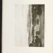
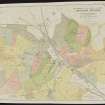
'Brandsbutt' is depicted on the OS 1st edition map (Aberdeenshire, sheet LIV, 1869). It has since been demolished.
Information from RCAHMS (HMLB), June 2001.

