
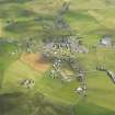
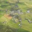
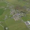
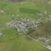
Dounby, Esgar


Burnt Mound(S) (Prehistoric)
Site Name Dounby, Esgar
Classification Burnt Mound(S) (Prehistoric)
Alternative Name(s) Quilco
Canmore ID 1842
Site Number HY22SE 11
NGR HY 29591 21068
Datum OSGB36 - NGR
Permalink http://canmore.org.uk/site/1842


- Council Orkney Islands
- Parish Birsay And Harray
- Former Region Orkney Islands Area
- Former District Orkney
- Former County Orkney
HY22SE 11 2958 2106.
(HY 2958 2107) Tumuli (NR)
OS 6" map, Orkney, 2nd ed., (1903).
Two mounds of burnt stones.
RCAHMS 1946.
Two amorphous turf-covered mounds of small burnt stones and earth, 0.8m. high, known collectively as the 'Knowe of Esgar' (Information from Mr T Spence, Makerhouse, Dounby), situated at the edge of a marshy plain.
Resurveyed at 1/2500.
Visited by OS (NKB) 16 May 1967.
Scheduled as Esgar, Dounby.
Information from Historic Scotland, scheduling document dated 1 December 2000.
'The Orcadian' reports that Esgar Farm was the name of the place where burnt mounds and cists were found.
M Howe 2006
Field Visit (14 June 1929)
There are two burnt mounds a short distance NE of Dounby and adjoining the market stance.
RCAHMS 1946, visited 14 June 1929.
OS 6" map (1903) 'Tumuli'
Field Visit (16 May 1967)
Two amorphous turf-covered mounds of small burnt stones and earth, 0.8m. high, known collectively as the 'Knowe of Esgar' (Information from Mr T Spence, Makerhouse, Dounby), situated at the edge of a marshy plain.
Resurveyed at 1/2500.
Visited by OS (NKB) 16 May 1967.
Magnetometry (23 August 2006)
HY 295 210 This geophysical survey was commissioned by Bracewell Stirling Architects on behalf of Orkney Housing Association, as part of an archaeological evaluation in advance of a proposed housing development. A gradiometer survey was undertaken on 23 August 2006 over an area of just under 1ha covering the entire proposed development area and the scheduled burnt mounds. As well as confirming the presence of burnt material within the burnt mounds, the gradiometer survey has highlighted a number of more ephemeral magnetic anomalies outside the scheduled area that may be of archaeological significance. The survey has also highlighted areas of ridge-and-furrow ploughing. As ploughing itself does not magnetically enhance the soil, this suggests that these ploughing anomalies may be visible because they have disturbed magnetically enhanced material, possibly of archaeological origin.
Archive lodged with Geophysics Unit, Orkney College.
Sponsor: Orkney Housing Association.
S Ovenden 2006
Reference (2006)
'The Orcadian' reports that Esgar Farm was the name of the place where burnt mounds and cists were found.
M Howe 2006
Orkney Smr Note
There are two burnt mounds, a short distance NE of village of Dounby and adjoining the market stance.
Information from Orkney SMR [n.d.]

