
Pricing Change
New pricing for orders of material from this site will come into place shortly. Charges for supply of digital images, digitisation on demand, prints and licensing will be altered.
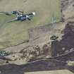
Stonehall


Farmstead (Period Unassigned)
Site Name Stonehall
Classification Farmstead (Period Unassigned)
Alternative Name(s) Stoneyhall
Canmore ID 182857
Site Number HY31SE 49
NGR HY 3667 1257
Datum OSGB36 - NGR
Permalink http://canmore.org.uk/site/182857

- Council Orkney Islands
- Parish Firth
- Former Region Orkney Islands Area
- Former District Orkney
- Former County Orkney
HY31SE 49 3667 1257
A farmstead, comprising two roofed buildings and one unroofed structure is depicted on the 1st edition of the OS 6-inch map (Orkney and Shetland (Orkney) 1882, sheet ci). Two roofed buildings are shown on the current edition of the OS 1:10000 map (1972).
Information from RCAHMS (AKK) 19 December 2000.

