
Black Cairn, Hill Of Rothmaise


Cairn (Period Unassigned)
Site Name Black Cairn, Hill Of Rothmaise
Classification Cairn (Period Unassigned)
Alternative Name(s) Tocherford
Canmore ID 18270
Site Number NJ63SE 8
NGR NJ 6882 3362
Datum OSGB36 - NGR
Permalink http://canmore.org.uk/site/18270


- Council Aberdeenshire
- Parish Rayne
- Former Region Grampian
- Former District Gordon
- Former County Aberdeenshire
NJ63SE 8 6882 3362.
(NJ 6882 3362) Black Cairn (NR)
OS 6" map, (1959)
A green mound, partially opened c. 1820, revealing a stone cist and a 'key of rude workmanship'.
Name Book 1867.
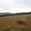
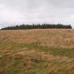
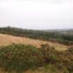
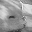
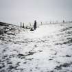
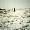
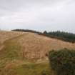
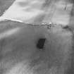
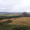
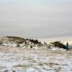
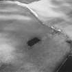
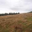
Black Cairn, a mutilated cairn, 21.0m in diameter and 2.0m in height situated on a conspicuous false crest. No trace of the cist.
Resurveyed at 1/2500.
Visited by OS (NKB) 3 March 1969.
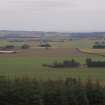
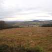
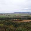
This mutilated cairn is situated on a conspicuous false crest at an altitude of 240m OD.
NMRS, MS/712/63.
This cairn is situated on a false crest shoulder on the SW flank of Hill of Rothmaise. It measures 23m in diameter by up to 2m in height, but it has been heavily robbed, especially on the S side. The cairn appears to be enclosed by a shallow ditch, which measures up to 3.5m in breadth by 0.2m in depth, where it is best preserved on the N.
Visited by RCAHMS (JRS, IF), 21 February 1996.
Scheduled as 'Black Cairn... 9990m NW of Tocherford'.
Information from Historic Scotland, scheduling document dated 19 December 2007.

