
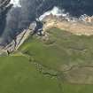
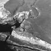
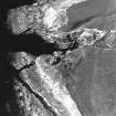
Yesnaby, Brough Burn


Rig And Furrow (Medieval) - (Post Medieval)
Site Name Yesnaby, Brough Burn
Classification Rig And Furrow (Medieval) - (Post Medieval)
Alternative Name(s) Broch Of Borwick
Canmore ID 173924
Site Number HY21NW 44
NGR HY 2255 1675
NGR Description Centred HY 2255 1675
Datum OSGB36 - NGR
Permalink http://canmore.org.uk/site/173924


- Council Orkney Islands
- Parish Sandwick
- Former Region Orkney Islands Area
- Former District Orkney
- Former County Orkney
HY21NW 44 centred 2255 1675
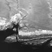
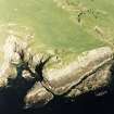
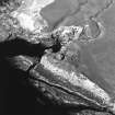
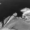
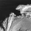
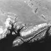
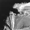
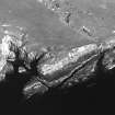
A small area of rig-and-furrow cultivation has been identified from obliqe aerial photographs (RCAHMSAP 1997), in a field to the SE of the Broch of Borwick (HY21NW 1) and between two burns, one which is annotated as the Brough Burn on the current edition of the OS 1:10000 scale map (1973).
Information from RCAHMS (DE), December 2000

