
North Sutor, Coast Battery; Battery Observation Post


Observation Post (Second World War)
Site Name North Sutor, Coast Battery; Battery Observation Post
Classification Observation Post (Second World War)
Alternative Name(s) Cromarty Defences; Fort North Sutor, Site No. 1
Canmore ID 170753
Site Number NH86NW 9.07
NGR NH 82158 68965
Datum OSGB36 - NGR
Permalink http://canmore.org.uk/site/170753


- Council Highland
- Parish Nigg (Ross And Cromarty)
- Former Region Highland
- Former District Ross And Cromarty
- Former County Ross And Cromarty
NH86NW 9.07 82158 68965
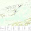
World War II brick and shuttered concrete battery observation post situated about 157m E and downslope from the gun-emplacements (NH86NW 9.02) and adjacent to the three level World War I Battery Observation post (NH86NW 9.03).
The structure has a large viewing platform with canopy and stands on a rectangular base. The block below the viewing platform is angular in design.
Internally, on the observation platform a ranging pillar survives. The canopy is now heavily warped with the steel support beam having been removed and is now in a potentially dangerous condition. Metal fixings for a drainpipe were noted on the ENE elevation.
Camouflage survives on this building, but whether it is contemporary World War II paint is not known.
Visited by RCAHMS, August 2000 and May 2002
Field Visit (13 March 2019)
This building, which is cut-back into a steep SE-facing slope less than 3m ESE of its Admiralty-built predecessor (NH86NW 9.3), formed part of the infrastructure of the battery introduced by the Army during World War 2. Its layout reflects four crucial activities: telecommunications on the ground floor, with the operation of the searchlights, range-finding and the directing of the fire of the battery on the first floor. The post measures 6.4m from NE to SW by 3.4m transversely and 4.6m tall overall. Although the ground floor is rectangular on plan, the upper floor is distinguished on the S and E by broad chamfered corners, in order to accommodate a wrap-around observation window facing SE positioned immediately above. However, the T-shaped iron supports that once held the shutters in place when these were folded downwards have been cut-off and reduced to mere stumps. The SW elevation is distinguished by a doorway at ground level situated immediately below the chamfered S corner, while the NE elevation by contrast is largely plain, save for the emergence of a chimney pipe from the ground floor and two metal brackets above that originally held extensions of the pipework in place. The NW elevation contains two rectangular windows with cast concrete lintels which light the lower compartment. These were originally shuttered, but only the metal hinges now remain. The windows are widely spaced, being located close to each corner, in order to accommodate a flight of five steps to the upper floor. These steps lead to a projecting threshold in front of two doors, only 0.48m apart, from which the iron frameworks have been robbed. A chimney pipe emerges just below roof level close to the building’s N corner. All the walls have been camouflaged with whitewash and colourwashes of brown, orange and green, while the flat, overhanging concrete roof which is also rectangular on plan is waterproofed with a layer of bitumen.
Internally, the ground floor compartment measures 5.95m from NE to SW by 2.73m transversely within walls 0.3m thick and 2.13m high. The ceiling and upper section of the walls have been whitewashed, but their lower half have also been colour washed with broad black and brown horizontal stripes, in addition to patches of blue. Two buttresses located in the centre of the walls at each end of the room are integral to the support of the whole structure, while the chamfer-cornered ranging pillar rises through the ceiling into the story above. It measures 0.36m square and like the rest of the room is half whitewashed and half colour-washed brown. An L-shaped electrical cable duct is sunk into the cement floor, while the chimney pipe penetrating the NE wall indicated that a stove once stood below it. Fragmentary pipework against the SE wall once conveyed further wiring through the upper floor; while several other pipes, wooden boards, battens and plugs, as well as marks on the other walls indicate the former presence of more electrical equipment. Four small rectangular apertures which pass through the SE wall at floor-level may be drainage channels.
The upper compartment is sub-rectangular on plan on account of the chamfered corners and 2.22m high. The ceiling and upper section of its walls have also been whitewashed, while traces of brown and blue colourwash occur on their lower half. Although the two doorways in the NW elevation suggest that the interior was once sub-divided, confirmation is provided by a narrow iron-lined channel in the floor which runs from between them to the SE. The free-standing ranging pillar passing through the concrete floor, which is collared here by a broken square plinth, occupied the SW compartment. The chimney pipe penetrating the NW wall indicates that a stove once stood below it in the NE compartment. Sockets beneath the wrap-around window, together with wooden plugs and metal pegs in the other walls are all that remain of shelves and various fittings for additional electrical equipment. However, the removal of a steel strut spanning the space between the NE and SW pillars at each end of the building has led the canopy to sag and crack above the wrap-around window.
Gorse- and grass-grown spoil from the excavation of the ground floor is situated to the SE of the post; a narrow trench to the SW is the result of robbing an electrical cable.
The building is annotated ‘B.O.P.’ (i.e. Battery Observation Post) on an undated sketch map entitled ‘Layout of Fort North Sutor’, which is bound into the Fort Record Book held in the National Archives at Kew (WO192/248).
Visited by HES, Survey and Recording (ATW, AKK), 13 March 2019

