
Drumcharry


Farmstead (Period Unassigned), Township (Period Unassigned)
Site Name Drumcharry
Classification Farmstead (Period Unassigned), Township (Period Unassigned)
Canmore ID 167477
Site Number NN74NE 122
NGR NN 75990 47979
Datum OSGB36 - NGR
Permalink http://canmore.org.uk/site/167477


- Council Perth And Kinross
- Parish Fortingall
- Former Region Tayside
- Former District Perth And Kinross
- Former County Perthshire
NMRS REFERENCE:
Drumcharry, Fortingal.
Architect: Dunn and Watson, c. 1890s.
Field Visit (March 2004)
NN74NE 122 75990 47979.
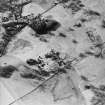
NN 7599 4800 (centre) The site of a former rural township at Drumcharry, to the NE of Fortingall, was evaluated and surveyed in March 2004 prior to a new housing development. The site contains a later farm and steading which are now vacant and partially derelict, as well as a number of derelict buildings from the township.
An old shieling track passes by the top of the site to the N, and seems to have been the main means of access to the township. Above this is the head dyke, defining the upper limits of cultivation. To the W, there seem to have been building platforms and perhaps garden plots terraced down the slope on this side of the settlement.
The extant ruins and house platforms closely correspond to the township as mapped in 1867, and probably reflect the earlier development of the settlement. However, no artefacts or structures that were clearly earlier were found.
Archive to be deposited in the NMRS.
Sponsor: Bon Accord Developments Ltd.
C Fyles 2004
Note (14 March 2006)
This modified township comprises a scatter of buildings, a number of which appear to have been dwellings, and a farmstead of L-shaped plan which includes a barn and a byre. When visited in 2000 the site was mostly disused.
Information from RCAHMS (SS), 14 March 2006.
Related sites:
NN74NE 54.00 75949 48040 N-W Croft
NN74NE 54.01 75949 48040 Store.
NN74NE 54.02 75979 48060 N-E Croft
NN74NE 54.03 7599 4800 Drumcharry

