
Little Conval


Field System (Prehistoric), Fort (Prehistoric), Palisade(S) (Prehistoric)
Site Name Little Conval
Classification Field System (Prehistoric), Fort (Prehistoric), Palisade(S) (Prehistoric)
Canmore ID 16307
Site Number NJ23NE 1
NGR NJ 2942 3930
Datum OSGB36 - NGR
Permalink http://canmore.org.uk/site/16307


- Council Moray
- Parish Mortlach
- Former Region Grampian
- Former District Moray
- Former County Banffshire
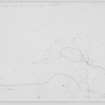
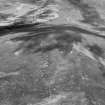
The remains of a prehistoric fort occupy the top of Little Conval, a prominent hill with commanding views in all directions. It was defended by twin palisades, which enclose an area measuring about 200m by 120m.
Text prepared by RCAHMS as part of the Accessing Scotland's Past project
NJ23NE 1 2942 3930
(NJ 294 393) Camp (NR).
OS 6" map, Banffshire, 2nd ed., (1905)
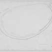
A hill fort with internal measurements of 680 by 400ft. The innermost defences, which were incompleted, comprise a spread wall and marker trench. Outside this is a second marker trench, and a third line starts off 75ft outside the second which becomes a wall 6ft thick faced with large slabs. This ends among a group of shapeless enclosures which may be contemporary with the fort. A fourth line comprises a bank 110 yards long covering the N approach.
R W Feachem 1963.
An unfinished fort as described and planned by Feachem.
The group of 'shapeless enclosures' indicated by Feachem on the gentle slopes to the SE of the hill fort are the remains of a field system.
The fields, two of which measure about 22.0m by about 30.0m and about 42.0m by about 24.0m, are defined by positive and negative lynchets and low stony banks. The system is clearly contemporary with the fort.
Visited by OS (R L) 20 May 1967; Visible on OS air photograph 64:183:023
At Durn Hill [NJ56SE 4] the embryo rampart was aligned on the marker bank. The relationship between the alignments of marker and proposed defence are seen again at the unfinished fort on Little Conval, Banffshire (Feachem 1963), where two lines of defence were marked out with ditches, as at the postulated earlier phases at Durn Hill (fig. 4). The marker ditches were hewn through the sparse topsoil into the uppermost layer of rock, the spoil being dispersed downhill. Construction of permanent defences began on the inner line, on either side of an entrance. Stones probably gathered from the hill were heaped over the marker ditch, utterly obliterating it. In due course the stones would presumably have been formed into a rampart, but when work stopped no actual building had begun. Some idea of the manner in which the work would probably have progressed can, however, be seen at another unfinished fort not far away [NH67NE 1].
R W Feachem 1971.
Field Visit (2 September 1954)
Visited by RCAHMS (RWF) 2 September 1954
Notebook MS 36/179
Field Visit (17 August 1956)
Fort, Little Conval
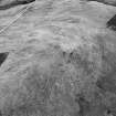
Little Conval Hill, which rises to a height of 1,810 ft. O. D., stands at a distance of two miles WSW of Dufftown and four miles S. of the junction of Glen Fiddich and Strathspey at Craigellachie. The N. flank of the hill falls gently to the moors NW. of Duff town, but the other flanks are considerably steeper , the S one falling 550 feet to the col leading to Meikle Conval and the other two descending for 1,000 ft. before reaching the limits of the cultivated lands below.
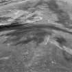
The summit of the hill, a comparatively flat area measuring about 700 ft. from N. to S. by about 400 ft. transversely was chosen for the site of a fort the construction of which was not completed. Two main and two subsidiary lines of defence can be distinguished. The inner, which encloses an area measuring 680 ft. in length by 400 ft. in breadth, consists for the most part of a line of boulders spread over a width of about 10 ft.; but for a distance of 400 ft. in the N. and NE. arcs this ceases altogether, and the line is only indicated by a marker trench. This can be traced through the heather and peat along the whole of the space between the ends of the line of boulders in the form of a shallow excavation of irregular width the mean of which is about 5 ft. , and along the inner lip of which is a very slight upcast mound. There is no visible indication that the boulders had ever been built into a regular wall with outer and inner faces, but the lowest courses of such features, had they existed , would probably have been buried in the debris. The only entrance is a gap about 10 ft. wide in the SW arc.
At a distance varying from as little as 12 ft. to as much as 48 ft. outside the inner defence is a line consisting entirely of stretches of marker trench. This could not be detected in the deep heather on the steep W. flank of the hill, although it is apparent as a dark line on aerial photographs. The first point at which it could be seen on the date of visit was at a point distance 26 feet from the WSW. arc of the inner defence. It runs thence S. for 90 ft. to one side of a gap 35 ft. wide which covers the entrance in the inner defence. Thereafter, it continues to follow the S. and SE flanks of the latter, interrupted by a gap of only 15 ft. in the E. arc. At a point 175 ft. N of this there is a pronounced kink in the course of the trench which thereafter continues round the N. arc to be lost again on the steep W. slope of the h ill. This marker trench, like the section already described, is shallow and of irregular width and depth, possibly as the result of several separate gangs having worked on its construction. For most of its course this trench has a very slight heap of small stone sand earth outside it.
While the lay-out of these two embryo lines of defence is unexceptionable, that of the next to be described is less regular. It starts on the steep W slope of the hill at a point 75 ft. outside the second marker trench and 95 ft. outside the rubble of the innermost line in the form of a marker trench similar to the others varying from 6 inches to one ft. in depth and f r om 2 ft. to 4 ft. in width and showing traces of gang work. It runs thence E and SE for a distance of about 600 ft., thus forming the basis of a third line to cover the weakest approach to the summit of the hill. Thereafter, however, it immediately becomes a wall 6 ft. in thickness, with facing stones on either side including some measuring about 6 ft. in length, 2 ft. 6 inches in thickness and one ft. in depth, apparently quarried but not dressed, and also large gathered boulder s of comparable size. The filling is of smaller stones. This wall continues S. along the steepening E. flank of the hill, and after making a salient to the E. finishes abruptly on the SE flank of the hill, at a point distant 200 ft. from the second line described above. No trace of wall or marker trench exists beyond this point, but this part of the hillside bears numerous apparently ancient stone field boundaries, and it is possible that the abrupt ending of the remainder of the wall and the lack of any further work beyond this may be related to their presence. It is, however, difficult to account for the presence of the salient.
A fourth line of defence occurs on the gentle N slope at a distance varying from 30 ft. to 60 ft. outside the marker trench which forms the N. arc of the third line. It consists of a slight low bank about 4 ft. in width and 330 ft. in length.
The interior of the fort is covered in peat and heather, and cloudberries grow in profusion in the NE. part. There are no traces of internal structures.
295393 xxiv SE (‘Camp’)
Visited by RCAHMS, 17 August 1956
Note (3 April 2015 - 18 October 2016)
This fortification encloses the broad summit of Little Conval, the conical hill rising up due W of Dufftown. The character of the defences is not entirely clear, for while Richard Feachem identified this as the remains of an unfinished hillfort, with a rubble bank some 3m in maximum breadth representing the incomplete rampart round most of the circuit, but with only marker trenches about 1.2m in breadth and up to 0.3m in depth to complete the circuit on the NE and set out up to three outer lines elsewhere on the N and E, a more recent visit by RCAHMS investigators concluded that it was more likely that these features had supported massive palisades. The inner enclosure is oval on plan, measuring about 210m from N to S by 120m transversely (2ha) within the rubble bank, and is encircled by a second trench at a distance ranging from 5m and 14m outside it. Gaps in this outer trench on the ESE and SW probably mark the positions of entrances, though there are no corresponding breaks in the rubble bank, perhaps indicating that it is a later construction. In addition to these two lines, another two trenches cut across the spine of the hill on the N at intervals of 10m and 15m to protect the easiest line of approach up a relatively gentle slope, the inner swinging around the E flank where its line is apparently taken up by a stony bank that turns down the slope on the SE and peters out in an area of small field plots. The interior is featureless.
Information from An Atlas of Hillforts of Great Britain and Ireland – 18 October 2016. Atlas of Hillforts SC2933

