
Edinburgh, Holyrood Park, Arthur's Seat


Enclosure (Period Unassigned)
Site Name Edinburgh, Holyrood Park, Arthur's Seat
Classification Enclosure (Period Unassigned)
Alternative Name(s) Queen's Park; Crow Hill
Canmore ID 157271
Site Number NT27SE 3959
NGR NT 2767 7293
NGR Description Centred NT 2767 7293
Datum OSGB36 - NGR
Permalink http://canmore.org.uk/site/157271


- Council Edinburgh, City Of
- Parish Edinburgh (Edinburgh, City Of)
- Former Region Lothian
- Former District City Of Edinburgh
- Former County Midlothian
Field Visit (15 December 1998)
NT27SE 3959 centred 2767 7293
See also NT27SE 93.
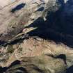
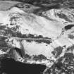
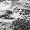
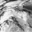
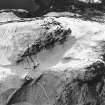
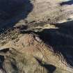
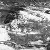
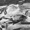
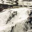
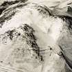
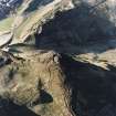
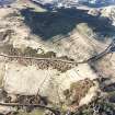
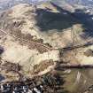
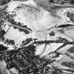
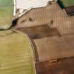
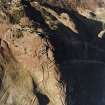
A large subrectangular enclosure occupies the saddle between the summits of Arthur's Seat and Crow Hill, and incorporates the ramparts of the fort NT27SE 93 at its NE end. The enclosure measures 110m from NE to SW by 75m transversely and is defined for much of its perimeter by a stony bank 2m thick and up to 0.4m high; on the NW, the perimeter forms little more than a narrow terrace, skirting the edge of the saddle. The N corner of the enclosure cannot now be seen, coinciding with an exposure of outcrop and the location of excavation trenches, opened in 1995 in advance of the construction of a new footpath (Alexander 1997). Breaks in the ends of the enclosure may indicate the positions of original entrances. However, no trace of the cultivation remains recorded in previous reports was visible within the enclosure on the date of visit. Where the saddle narrows on the NE, short stretches of stony banks link the walls overlying the two fort ramparts to form an annexe. Within the annexe, there is a circular hollow of unknown date, which may be a well. A further stretch of bank is situated downslope to the NE, and extends for a distance of about 35m from the foot of rock outcrop. The enclosure and bank are plotted at 1:5,550 on an archaeological map of Holyrood Park (RCAHMS 1999).
Visited by RCAHMS (ARG), 15 December 1998
D Alexander 1997; RCAHMS 1999.

