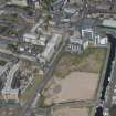
Edinburgh, Grove Street, General
General View
Site Name Edinburgh, Grove Street, General
Classification General View
Canmore ID 156997
Site Number NT27SW 3066
NGR NT 24370 73135
Datum OSGB36 - NGR
Permalink http://canmore.org.uk/site/156997
- Council Edinburgh, City Of
- Parish Edinburgh (Edinburgh, City Of)
- Former Region Lothian
- Former District City Of Edinburgh
- Former County Midlothian
Grove Street was first conceived in the 1820s as being formed in three parts, with North and South Grove Streets leading to a central Grove Square. It was to be built on the Grove property of John Bonar Esq. It was never built in this form.
By 1849 the lowest number buildings on Grove Street, had been built, running south from Morrison Street. Across the railway bridge, the road was known as Grove Lane, and was little built up. It lead to Fountainbridge.
Over the next few years the street, and the adjoining streets of Upper Grove Place and Brandfield Street, were completed. They are shown as fully formed on the OS 1st Edition map, published in 1856.


