
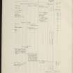
Islay, Ballychatrigan


Head Dyke (Post Medieval), Township (Period Unassigned)
Site Name Islay, Ballychatrigan
Classification Head Dyke (Post Medieval), Township (Period Unassigned)
Canmore ID 154028
Site Number NR34SW 55
NGR NR 3256 4201
NGR Description Centred on NR 3256 4201
Datum OSGB36 - NGR
Permalink http://canmore.org.uk/site/154028
Ordnance Survey licence number AC0000807262. All rights reserved.
Canmore Disclaimer.
© Copyright and database right 2024.
- Correction
- Favourite

SC 2139382
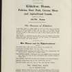
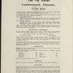
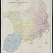
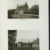
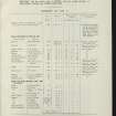
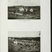
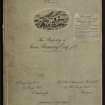
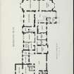
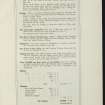
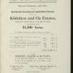
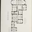
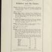
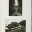
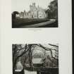
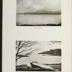
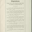
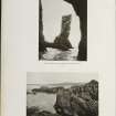
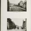
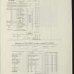
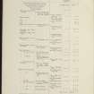
Estate Exchange. Kildalton and Oa Esatates. no. 1484 Sales Brochure. Includes details of 4 different lots: Corraray (lot 4), Lower Cragabus (lot 2), Castlehill, Duich (lot 4), Kilbride (lot 3), Machrie (lot 3) etc. Map and text. Title: 'The Kildalton and Oa Estates, Argyllshire. The Property of Iain Ramsay Esq. J.P.'
Collection of sale catalogues relating to Scottish estates
25/6/1914
© Courtesy of HES (Estates Exchange collection)

SC 2139392
Estate Exchange. Kildalton and Oa Esatates. no. 1484 Sales Brochure. Includes details of 4 different lots: Corraray (lot 4), Lower Cragabus (lot 2), Castlehill, Duich (lot 4), Kilbride (lot 3), Machrie (lot 3) etc. Map and text. Title: 'The Kildalton and Oa Estates, Argyllshire. The Property of Iain Ramsay Esq. J.P.'
Collection of sale catalogues relating to Scottish estates
25/6/1914
© Courtesy of HES (Estates Exchange collection)

SC 2139397
Estate Exchange. Kildalton and Oa Esatates. no. 1484 Sales Brochure. Includes details of 4 different lots: Corraray (lot 4), Lower Cragabus (lot 2), Castlehill, Duich (lot 4), Kilbride (lot 3), Machrie (lot 3) etc. Map and text. Title: 'The Kildalton and Oa Estates, Argyllshire. The Property of Iain Ramsay Esq. J.P.'
Collection of sale catalogues relating to Scottish estates
25/6/1914
© Courtesy of HES (Estates Exchange collection)

SC 2139414
Estate Exchange. Kildalton and Oa Esatates. no. 1484 Sales Brochure. Includes details of 4 different lots: Corraray (lot 4), Lower Cragabus (lot 2), Castlehill, Duich (lot 4), Kilbride (lot 3), Machrie (lot 3) etc. Map and text. Title: 'The Kildalton and Oa Estates, Argyllshire. The Property of Iain Ramsay Esq. J.P.'
Collection of sale catalogues relating to Scottish estates
25/6/1914
© Courtesy of HES (Estates Exchange collection)

SC 2139433
Estate Exchange. Kildalton and Oa Esatates. no. 1484 Sales Brochure. Includes details of 4 different lots: Corraray (lot 4), Lower Cragabus (lot 2), Castlehill, Duich (lot 4), Kilbride (lot 3), Machrie (lot 3) etc. Map and text. Title: 'The Kildalton and Oa Estates, Argyllshire. The Property of Iain Ramsay Esq. J.P.'
Collection of sale catalogues relating to Scottish estates
25/6/1914
© Courtesy of HES (Estates Exchange collection)

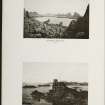
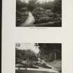
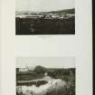
DP 021129
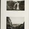
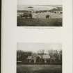
Oblique aerial view centred on the remains of the township, taken from the WNW.
RCAHMS Aerial Photography Digital
2/11/2006
© Crown Copyright: HES

DP 021130
Oblique aerial view centred on the remains of the township, taken from the SW.
RCAHMS Aerial Photography Digital
2/11/2006
© Crown Copyright: HES

SC 2139379
Estate Exchange. Kildalton and Oa Esatates. no. 1484 Sales Brochure. Includes details of 4 different lots: Corraray (lot 4), Lower Cragabus (lot 2), Castlehill, Duich (lot 4), Kilbride (lot 3), Machrie (lot 3) etc. Map and text. Title: 'The Kildalton and Oa Estates, Argyllshire. The Property of Iain Ramsay Esq. J.P.'
Collection of sale catalogues relating to Scottish estates
25/6/1914
© Courtesy of HES (Estates Exchange collection)

SC 2139388
Estate Exchange. Kildalton and Oa Esatates. no. 1484 Sales Brochure. Includes details of 4 different lots: Corraray (lot 4), Lower Cragabus (lot 2), Castlehill, Duich (lot 4), Kilbride (lot 3), Machrie (lot 3) etc. Map and text. Title: 'The Kildalton and Oa Estates, Argyllshire. The Property of Iain Ramsay Esq. J.P.'
Collection of sale catalogues relating to Scottish estates
25/6/1914
© Courtesy of HES (Estates Exchange collection)

SC 2139390
Estate Exchange. Kildalton and Oa Esatates. no. 1484 Sales Brochure. Includes details of 4 different lots: Corraray (lot 4), Lower Cragabus (lot 2), Castlehill, Duich (lot 4), Kilbride (lot 3), Machrie (lot 3) etc. Map and text. Title: 'The Kildalton and Oa Estates, Argyllshire. The Property of Iain Ramsay Esq. J.P.'
Collection of sale catalogues relating to Scottish estates
25/6/1914
© Courtesy of HES (Estates Exchange collection)

SC 2139393
Estate Exchange. Kildalton and Oa Esatates. no. 1484 Sales Brochure. Includes details of 4 different lots: Corraray (lot 4), Lower Cragabus (lot 2), Castlehill, Duich (lot 4), Kilbride (lot 3), Machrie (lot 3) etc. Map and text. Title: 'The Kildalton and Oa Estates, Argyllshire. The Property of Iain Ramsay Esq. J.P.'
Collection of sale catalogues relating to Scottish estates
25/6/1914
© Courtesy of HES (Estates Exchange collection)

SC 2139394
Estate Exchange. Kildalton and Oa Esatates. no. 1484 Sales Brochure. Includes details of 4 different lots: Corraray (lot 4), Lower Cragabus (lot 2), Castlehill, Duich (lot 4), Kilbride (lot 3), Machrie (lot 3) etc. Map and text. Title: 'The Kildalton and Oa Estates, Argyllshire. The Property of Iain Ramsay Esq. J.P.'
Collection of sale catalogues relating to Scottish estates
25/6/1914
© Courtesy of HES (Estates Exchange collection)

SC 2139396
Estate Exchange. Kildalton and Oa Esatates. no. 1484 Sales Brochure. Includes details of 4 different lots: Corraray (lot 4), Lower Cragabus (lot 2), Castlehill, Duich (lot 4), Kilbride (lot 3), Machrie (lot 3) etc. Map and text. Title: 'The Kildalton and Oa Estates, Argyllshire. The Property of Iain Ramsay Esq. J.P.'
Collection of sale catalogues relating to Scottish estates
25/6/1914
© Courtesy of HES (Estates Exchange collection)

SC 2139398
Estate Exchange. Kildalton and Oa Esatates. no. 1484 Sales Brochure. Includes details of 4 different lots: Corraray (lot 4), Lower Cragabus (lot 2), Castlehill, Duich (lot 4), Kilbride (lot 3), Machrie (lot 3) etc. Map and text. Title: 'The Kildalton and Oa Estates, Argyllshire. The Property of Iain Ramsay Esq. J.P.'
Collection of sale catalogues relating to Scottish estates
25/6/1914
© Courtesy of HES (Estates Exchange collection)

SC 2139410
Estate Exchange. Kildalton and Oa Esatates. no. 1484 Sales Brochure. Includes details of 4 different lots: Corraray (lot 4), Lower Cragabus (lot 2), Castlehill, Duich (lot 4), Kilbride (lot 3), Machrie (lot 3) etc. Map and text. Title: 'The Kildalton and Oa Estates, Argyllshire. The Property of Iain Ramsay Esq. J.P.'
Collection of sale catalogues relating to Scottish estates
25/6/1914
© Courtesy of HES (Estates Exchange collection)

SC 2139413
Estate Exchange. Kildalton and Oa Esatates. no. 1484 Sales Brochure. Includes details of 4 different lots: Corraray (lot 4), Lower Cragabus (lot 2), Castlehill, Duich (lot 4), Kilbride (lot 3), Machrie (lot 3) etc. Map and text. Title: 'The Kildalton and Oa Estates, Argyllshire. The Property of Iain Ramsay Esq. J.P.'
Collection of sale catalogues relating to Scottish estates
25/6/1914
© Courtesy of HES (Estates Exchange collection)

SC 2139428
Estate Exchange. Kildalton and Oa Esatates. no. 1484 Sales Brochure. Includes details of 4 different lots: Corraray (lot 4), Lower Cragabus (lot 2), Castlehill, Duich (lot 4), Kilbride (lot 3), Machrie (lot 3) etc. Map and text. Title: 'The Kildalton and Oa Estates, Argyllshire. The Property of Iain Ramsay Esq. J.P.'
Collection of sale catalogues relating to Scottish estates
25/6/1914
© Courtesy of HES (Estates Exchange collection)

SC 2139430
Estate Exchange. Kildalton and Oa Esatates. no. 1484 Sales Brochure. Includes details of 4 different lots: Corraray (lot 4), Lower Cragabus (lot 2), Castlehill, Duich (lot 4), Kilbride (lot 3), Machrie (lot 3) etc. Map and text. Title: 'The Kildalton and Oa Estates, Argyllshire. The Property of Iain Ramsay Esq. J.P.'
Collection of sale catalogues relating to Scottish estates
25/6/1914
© Courtesy of HES (Estates Exchange collection)

SC 2139438
Estate Exchange. Kildalton and Oa Esatates. no. 1484 Sales Brochure. Includes details of 4 different lots: Corraray (lot 4), Lower Cragabus (lot 2), Castlehill, Duich (lot 4), Kilbride (lot 3), Machrie (lot 3) etc. Map and text. Title: 'The Kildalton and Oa Estates, Argyllshire. The Property of Iain Ramsay Esq. J.P.'
Collection of sale catalogues relating to Scottish estates
25/6/1914
© Courtesy of HES (Estates Exchange collection)

SC 2139445
Estate Exchange. Kildalton and Oa Esatates. no. 1484 Sales Brochure. Includes details of 4 different lots: Corraray (lot 4), Lower Cragabus (lot 2), Castlehill, Duich (lot 4), Kilbride (lot 3), Machrie (lot 3) etc. Map and text. Title: 'The Kildalton and Oa Estates, Argyllshire. The Property of Iain Ramsay Esq. J.P.'
Collection of sale catalogues relating to Scottish estates
25/6/1914
© Courtesy of HES (Estates Exchange collection)

SC 2139448
Estate Exchange. Kildalton and Oa Esatates. no. 1484 Sales Brochure. Includes details of 4 different lots: Corraray (lot 4), Lower Cragabus (lot 2), Castlehill, Duich (lot 4), Kilbride (lot 3), Machrie (lot 3) etc. Map and text. Title: 'The Kildalton and Oa Estates, Argyllshire. The Property of Iain Ramsay Esq. J.P.'
Collection of sale catalogues relating to Scottish estates
25/6/1914
© Courtesy of HES (Estates Exchange collection)

SC 2139449
Estate Exchange. Kildalton and Oa Esatates. no. 1484 Sales Brochure. Includes details of 4 different lots: Corraray (lot 4), Lower Cragabus (lot 2), Castlehill, Duich (lot 4), Kilbride (lot 3), Machrie (lot 3) etc. Map and text. Title: 'The Kildalton and Oa Estates, Argyllshire. The Property of Iain Ramsay Esq. J.P.'
Collection of sale catalogues relating to Scottish estates
25/6/1914
© Courtesy of HES (Estates Exchange collection)

SC 2139450
Estate Exchange. Kildalton and Oa Esatates. no. 1484 Sales Brochure. Includes details of 4 different lots: Corraray (lot 4), Lower Cragabus (lot 2), Castlehill, Duich (lot 4), Kilbride (lot 3), Machrie (lot 3) etc. Map and text. Title: 'The Kildalton and Oa Estates, Argyllshire. The Property of Iain Ramsay Esq. J.P.'
Collection of sale catalogues relating to Scottish estates
25/6/1914
© Courtesy of HES (Estates Exchange collection)

SC 2139399
Estate Exchange. Kildalton and Oa Esatates. no. 1484 Sales Brochure. Includes details of 4 different lots: Corraray (lot 4), Lower Cragabus (lot 2), Castlehill, Duich (lot 4), Kilbride (lot 3), Machrie (lot 3) etc. Map and text. Title: 'The Kildalton and Oa Estates, Argyllshire. The Property of Iain Ramsay Esq. J.P.'
Collection of sale catalogues relating to Scottish estates
25/6/1914
© Courtesy of HES (Estates Exchange collection)

SC 2139401
Estate Exchange. Kildalton and Oa Esatates. no. 1484 Sales Brochure. Includes details of 4 different lots: Corraray (lot 4), Lower Cragabus (lot 2), Castlehill, Duich (lot 4), Kilbride (lot 3), Machrie (lot 3) etc. Map and text. Title: 'The Kildalton and Oa Estates, Argyllshire. The Property of Iain Ramsay Esq. J.P.'
Collection of sale catalogues relating to Scottish estates
25/6/1914
© Courtesy of HES (Estates Exchange collection)

SC 2139407
Estate Exchange. Kildalton and Oa Esatates. no. 1484 Sales Brochure. Includes details of 4 different lots: Corraray (lot 4), Lower Cragabus (lot 2), Castlehill, Duich (lot 4), Kilbride (lot 3), Machrie (lot 3) etc. Map and text. Title: 'The Kildalton and Oa Estates, Argyllshire. The Property of Iain Ramsay Esq. J.P.'
Collection of sale catalogues relating to Scottish estates
25/6/1914
© Courtesy of HES (Estates Exchange collection)

SC 2139415
Estate Exchange. Kildalton and Oa Esatates. no. 1484 Sales Brochure. Includes details of 4 different lots: Corraray (lot 4), Lower Cragabus (lot 2), Castlehill, Duich (lot 4), Kilbride (lot 3), Machrie (lot 3) etc. Map and text. Title: 'The Kildalton and Oa Estates, Argyllshire. The Property of Iain Ramsay Esq. J.P.'
Collection of sale catalogues relating to Scottish estates
25/6/1914
© Courtesy of HES (Estates Exchange collection)

SC 2139420
Estate Exchange. Kildalton and Oa Esatates. no. 1484 Sales Brochure. Includes details of 4 different lots: Corraray (lot 4), Lower Cragabus (lot 2), Castlehill, Duich (lot 4), Kilbride (lot 3), Machrie (lot 3) etc. Map and text. Title: 'The Kildalton and Oa Estates, Argyllshire. The Property of Iain Ramsay Esq. J.P.'
Collection of sale catalogues relating to Scottish estates
25/6/1914
© Courtesy of HES (Estates Exchange collection)

SC 2139427
Estate Exchange. Kildalton and Oa Esatates. no. 1484 Sales Brochure. Includes details of 4 different lots: Corraray (lot 4), Lower Cragabus (lot 2), Castlehill, Duich (lot 4), Kilbride (lot 3), Machrie (lot 3) etc. Map and text. Title: 'The Kildalton and Oa Estates, Argyllshire. The Property of Iain Ramsay Esq. J.P.'
Collection of sale catalogues relating to Scottish estates
25/6/1914
© Courtesy of HES (Estates Exchange collection)

SC 2139431
Estate Exchange. Kildalton and Oa Esatates. no. 1484 Sales Brochure. Includes details of 4 different lots: Corraray (lot 4), Lower Cragabus (lot 2), Castlehill, Duich (lot 4), Kilbride (lot 3), Machrie (lot 3) etc. Map and text. Title: 'The Kildalton and Oa Estates, Argyllshire. The Property of Iain Ramsay Esq. J.P.'
Collection of sale catalogues relating to Scottish estates
25/6/1914
© Courtesy of HES (Estates Exchange collection)

SC 2139444
Estate Exchange. Kildalton and Oa Esatates. no. 1484 Sales Brochure. Includes details of 4 different lots: Corraray (lot 4), Lower Cragabus (lot 2), Castlehill, Duich (lot 4), Kilbride (lot 3), Machrie (lot 3) etc. Map and text. Title: 'The Kildalton and Oa Estates, Argyllshire. The Property of Iain Ramsay Esq. J.P.'
Collection of sale catalogues relating to Scottish estates
25/6/1914
© Courtesy of HES (Estates Exchange collection)

SC 2139446
Estate Exchange. Kildalton and Oa Esatates. no. 1484 Sales Brochure. Includes details of 4 different lots: Corraray (lot 4), Lower Cragabus (lot 2), Castlehill, Duich (lot 4), Kilbride (lot 3), Machrie (lot 3) etc. Map and text. Title: 'The Kildalton and Oa Estates, Argyllshire. The Property of Iain Ramsay Esq. J.P.'
Collection of sale catalogues relating to Scottish estates
25/6/1914
© Courtesy of HES (Estates Exchange collection)

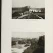
DP 021127
Oblique aerial view centred on the remains of the township with the farmsteading adjacent, taken from the ESE.
RCAHMS Aerial Photography Digital
2/11/2006
© Crown Copyright: HES

DP 021128
Oblique aerial view centred on the remains of the township with the farmsteading adjacent, taken from the NNW.
RCAHMS Aerial Photography Digital
2/11/2006
© Crown Copyright: HES

SC 2139412
Estate Exchange. Kildalton and Oa Esatates. no. 1484 Sales Brochure. Includes details of 4 different lots: Corraray (lot 4), Lower Cragabus (lot 2), Castlehill, Duich (lot 4), Kilbride (lot 3), Machrie (lot 3) etc. Map and text. Title: 'The Kildalton and Oa Estates, Argyllshire. The Property of Iain Ramsay Esq. J.P.'
Collection of sale catalogues relating to Scottish estates
25/6/1914
© Courtesy of HES (Estates Exchange collection)

SC 2139416
Estate Exchange. Kildalton and Oa Esatates. no. 1484 Sales Brochure. Includes details of 4 different lots: Corraray (lot 4), Lower Cragabus (lot 2), Castlehill, Duich (lot 4), Kilbride (lot 3), Machrie (lot 3) etc. Map and text. Title: 'The Kildalton and Oa Estates, Argyllshire. The Property of Iain Ramsay Esq. J.P.'
Collection of sale catalogues relating to Scottish estates
25/6/1914
© Courtesy of HES (Estates Exchange collection)

SC 2139423
Estate Exchange. Kildalton and Oa Esatates. no. 1484 Sales Brochure. Includes details of 4 different lots: Corraray (lot 4), Lower Cragabus (lot 2), Castlehill, Duich (lot 4), Kilbride (lot 3), Machrie (lot 3) etc. Map and text. Title: 'The Kildalton and Oa Estates, Argyllshire. The Property of Iain Ramsay Esq. J.P.'
Collection of sale catalogues relating to Scottish estates
25/6/1914
© Courtesy of HES (Estates Exchange collection)

SC 2139435
Estate Exchange. Kildalton and Oa Esatates. no. 1484 Sales Brochure. Includes details of 4 different lots: Corraray (lot 4), Lower Cragabus (lot 2), Castlehill, Duich (lot 4), Kilbride (lot 3), Machrie (lot 3) etc. Map and text. Title: 'The Kildalton and Oa Estates, Argyllshire. The Property of Iain Ramsay Esq. J.P.'
Collection of sale catalogues relating to Scottish estates
25/6/1914
© Courtesy of HES (Estates Exchange collection)

SC 2139437
Estate Exchange. Kildalton and Oa Esatates. no. 1484 Sales Brochure. Includes details of 4 different lots: Corraray (lot 4), Lower Cragabus (lot 2), Castlehill, Duich (lot 4), Kilbride (lot 3), Machrie (lot 3) etc. Map and text. Title: 'The Kildalton and Oa Estates, Argyllshire. The Property of Iain Ramsay Esq. J.P.'
Collection of sale catalogues relating to Scottish estates
25/6/1914
© Courtesy of HES (Estates Exchange collection)

SC 2139440
Estate Exchange. Kildalton and Oa Esatates. no. 1484 Sales Brochure. Includes details of 4 different lots: Corraray (lot 4), Lower Cragabus (lot 2), Castlehill, Duich (lot 4), Kilbride (lot 3), Machrie (lot 3) etc. Map and text. Title: 'The Kildalton and Oa Estates, Argyllshire. The Property of Iain Ramsay Esq. J.P.'
Collection of sale catalogues relating to Scottish estates
25/6/1914
© Courtesy of HES (Estates Exchange collection)

SC 2139447
Estate Exchange. Kildalton and Oa Esatates. no. 1484 Sales Brochure. Includes details of 4 different lots: Corraray (lot 4), Lower Cragabus (lot 2), Castlehill, Duich (lot 4), Kilbride (lot 3), Machrie (lot 3) etc. Map and text. Title: 'The Kildalton and Oa Estates, Argyllshire. The Property of Iain Ramsay Esq. J.P.'
Collection of sale catalogues relating to Scottish estates
25/6/1914
© Courtesy of HES (Estates Exchange collection)

DP 021131
Oblique aerial view centred on the remains of the township with the farmsteading adjacent, taken from the SSE.
RCAHMS Aerial Photography Digital
2/11/2006
© Crown Copyright: HES

SC 2139373
Estate Exchange. Kildalton and Oa Esatates. no. 1484 Sales Brochure. Includes details of 4 different lots: Corraray (lot 4), Lower Cragabus (lot 2), Castlehill, Duich (lot 4), Kilbride (lot 3), Machrie (lot 3) etc. Map and text. Title: 'The Kildalton and Oa Estates, Argyllshire. The Property of Iain Ramsay Esq. J.P.'
Collection of sale catalogues relating to Scottish estates
25/6/1914
© Courtesy of HES (Estates Exchange collection)

SC 2139375
Estate Exchange. Kildalton and Oa Esatates. no. 1484 Sales Brochure. Includes details of 4 different lots: Corraray (lot 4), Lower Cragabus (lot 2), Castlehill, Duich (lot 4), Kilbride (lot 3), Machrie (lot 3) etc. Map and text. Title: 'The Kildalton and Oa Estates, Argyllshire. The Property of Iain Ramsay Esq. J.P.'
Collection of sale catalogues relating to Scottish estates
25/6/1914
© Courtesy of HES (Estates Exchange collection)

SC 2139383
Estate Exchange. Kildalton and Oa Esatates. no. 1484 Sales Brochure. Includes details of 4 different lots: Corraray (lot 4), Lower Cragabus (lot 2), Castlehill, Duich (lot 4), Kilbride (lot 3), Machrie (lot 3) etc. Map and text. Title: 'The Kildalton and Oa Estates, Argyllshire. The Property of Iain Ramsay Esq. J.P.'
Collection of sale catalogues relating to Scottish estates
25/6/1914
© Courtesy of HES (Estates Exchange collection)

SC 2139389
Estate Exchange. Kildalton and Oa Esatates. no. 1484 Sales Brochure. Includes details of 4 different lots: Corraray (lot 4), Lower Cragabus (lot 2), Castlehill, Duich (lot 4), Kilbride (lot 3), Machrie (lot 3) etc. Map and text. Title: 'The Kildalton and Oa Estates, Argyllshire. The Property of Iain Ramsay Esq. J.P.'
Collection of sale catalogues relating to Scottish estates
25/6/1914
© Courtesy of HES (Estates Exchange collection)

SC 2139405
Estate Exchange. Kildalton and Oa Esatates. no. 1484 Sales Brochure. Includes details of 4 different lots: Corraray (lot 4), Lower Cragabus (lot 2), Castlehill, Duich (lot 4), Kilbride (lot 3), Machrie (lot 3) etc. Map and text. Title: 'The Kildalton and Oa Estates, Argyllshire. The Property of Iain Ramsay Esq. J.P.'
Collection of sale catalogues relating to Scottish estates
25/6/1914
© Courtesy of HES (Estates Exchange collection)

SC 2139406
Estate Exchange. Kildalton and Oa Esatates. no. 1484 Sales Brochure. Includes details of 4 different lots: Corraray (lot 4), Lower Cragabus (lot 2), Castlehill, Duich (lot 4), Kilbride (lot 3), Machrie (lot 3) etc. Map and text. Title: 'The Kildalton and Oa Estates, Argyllshire. The Property of Iain Ramsay Esq. J.P.'
Collection of sale catalogues relating to Scottish estates
25/6/1914
© Courtesy of HES (Estates Exchange collection)

SC 2139411
Estate Exchange. Kildalton and Oa Esatates. no. 1484 Sales Brochure. Includes details of 4 different lots: Corraray (lot 4), Lower Cragabus (lot 2), Castlehill, Duich (lot 4), Kilbride (lot 3), Machrie (lot 3) etc. Map and text. Title: 'The Kildalton and Oa Estates, Argyllshire. The Property of Iain Ramsay Esq. J.P.'
Collection of sale catalogues relating to Scottish estates
25/6/1914
© Courtesy of HES (Estates Exchange collection)

SC 2139417
Estate Exchange. Kildalton and Oa Esatates. no. 1484 Sales Brochure. Includes details of 4 different lots: Corraray (lot 4), Lower Cragabus (lot 2), Castlehill, Duich (lot 4), Kilbride (lot 3), Machrie (lot 3) etc. Map and text. Title: 'The Kildalton and Oa Estates, Argyllshire. The Property of Iain Ramsay Esq. J.P.'
Collection of sale catalogues relating to Scottish estates
25/6/1914
© Courtesy of HES (Estates Exchange collection)

SC 2139418
Estate Exchange. Kildalton and Oa Esatates. no. 1484 Sales Brochure. Includes details of 4 different lots: Corraray (lot 4), Lower Cragabus (lot 2), Castlehill, Duich (lot 4), Kilbride (lot 3), Machrie (lot 3) etc. Map and text. Title: 'The Kildalton and Oa Estates, Argyllshire. The Property of Iain Ramsay Esq. J.P.'
Collection of sale catalogues relating to Scottish estates
25/6/1914
© Courtesy of HES (Estates Exchange collection)

SC 2139429
Estate Exchange. Kildalton and Oa Esatates. no. 1484 Sales Brochure. Includes details of 4 different lots: Corraray (lot 4), Lower Cragabus (lot 2), Castlehill, Duich (lot 4), Kilbride (lot 3), Machrie (lot 3) etc. Map and text. Title: 'The Kildalton and Oa Estates, Argyllshire. The Property of Iain Ramsay Esq. J.P.'
Collection of sale catalogues relating to Scottish estates
25/6/1914
© Courtesy of HES (Estates Exchange collection)

SC 2139377
Estate Exchange. Kildalton and Oa Esatates. no. 1484 Sales Brochure. Includes details of 4 different lots: Corraray (lot 4), Lower Cragabus (lot 2), Castlehill, Duich (lot 4), Kilbride (lot 3), Machrie (lot 3) etc. Map and text. Title: 'The Kildalton and Oa Estates, Argyllshire. The Property of Iain Ramsay Esq. J.P.'
Collection of sale catalogues relating to Scottish estates
25/6/1914
© Courtesy of HES (Estates Exchange collection)

SC 2139380
Estate Exchange. Kildalton and Oa Esatates. no. 1484 Sales Brochure. Includes details of 4 different lots: Corraray (lot 4), Lower Cragabus (lot 2), Castlehill, Duich (lot 4), Kilbride (lot 3), Machrie (lot 3) etc. Map and text. Title: 'The Kildalton and Oa Estates, Argyllshire. The Property of Iain Ramsay Esq. J.P.'
Collection of sale catalogues relating to Scottish estates
25/6/1914
© Courtesy of HES (Estates Exchange collection)

SC 2139384
Estate Exchange. Kildalton and Oa Esatates. no. 1484 Sales Brochure. Includes details of 4 different lots: Corraray (lot 4), Lower Cragabus (lot 2), Castlehill, Duich (lot 4), Kilbride (lot 3), Machrie (lot 3) etc. Map and text. Title: 'The Kildalton and Oa Estates, Argyllshire. The Property of Iain Ramsay Esq. J.P.'
Collection of sale catalogues relating to Scottish estates
25/6/1914
© Courtesy of HES (Estates Exchange collection)

SC 2139386
Estate Exchange. Kildalton and Oa Esatates. no. 1484 Sales Brochure. Includes details of 4 different lots: Corraray (lot 4), Lower Cragabus (lot 2), Castlehill, Duich (lot 4), Kilbride (lot 3), Machrie (lot 3) etc. Map and text. Title: 'The Kildalton and Oa Estates, Argyllshire. The Property of Iain Ramsay Esq. J.P.'
Collection of sale catalogues relating to Scottish estates
25/6/1914
© Courtesy of HES (Estates Exchange collection)

SC 2139387
Estate Exchange. Kildalton and Oa Esatates. no. 1484 Sales Brochure. Includes details of 4 different lots: Corraray (lot 4), Lower Cragabus (lot 2), Castlehill, Duich (lot 4), Kilbride (lot 3), Machrie (lot 3) etc. Map and text. Title: 'The Kildalton and Oa Estates, Argyllshire. The Property of Iain Ramsay Esq. J.P.'
Collection of sale catalogues relating to Scottish estates
25/6/1914
© Courtesy of HES (Estates Exchange collection)

SC 2139391
Estate Exchange. Kildalton and Oa Esatates. no. 1484 Sales Brochure. Includes details of 4 different lots: Corraray (lot 4), Lower Cragabus (lot 2), Castlehill, Duich (lot 4), Kilbride (lot 3), Machrie (lot 3) etc. Map and text. Title: 'The Kildalton and Oa Estates, Argyllshire. The Property of Iain Ramsay Esq. J.P.'
Collection of sale catalogues relating to Scottish estates
25/6/1914
© Courtesy of HES (Estates Exchange collection)

SC 2139395
Estate Exchange. Kildalton and Oa Esatates. no. 1484 Sales Brochure. Includes details of 4 different lots: Corraray (lot 4), Lower Cragabus (lot 2), Castlehill, Duich (lot 4), Kilbride (lot 3), Machrie (lot 3) etc. Map and text. Title: 'The Kildalton and Oa Estates, Argyllshire. The Property of Iain Ramsay Esq. J.P.'
Collection of sale catalogues relating to Scottish estates
25/6/1914
© Courtesy of HES (Estates Exchange collection)

SC 2139421
Estate Exchange. Kildalton and Oa Esatates. no. 1484 Sales Brochure. Includes details of 4 different lots: Corraray (lot 4), Lower Cragabus (lot 2), Castlehill, Duich (lot 4), Kilbride (lot 3), Machrie (lot 3) etc. Map and text. Title: 'The Kildalton and Oa Estates, Argyllshire. The Property of Iain Ramsay Esq. J.P.'
Collection of sale catalogues relating to Scottish estates
25/6/1914
© Courtesy of HES (Estates Exchange collection)

SC 2139422
Estate Exchange. Kildalton and Oa Esatates. no. 1484 Sales Brochure. Includes details of 4 different lots: Corraray (lot 4), Lower Cragabus (lot 2), Castlehill, Duich (lot 4), Kilbride (lot 3), Machrie (lot 3) etc. Map and text. Title: 'The Kildalton and Oa Estates, Argyllshire. The Property of Iain Ramsay Esq. J.P.'
Collection of sale catalogues relating to Scottish estates
25/6/1914
© Courtesy of HES (Estates Exchange collection)

SC 2139425
Estate Exchange. Kildalton and Oa Esatates. no. 1484 Sales Brochure. Includes details of 4 different lots: Corraray (lot 4), Lower Cragabus (lot 2), Castlehill, Duich (lot 4), Kilbride (lot 3), Machrie (lot 3) etc. Map and text. Title: 'The Kildalton and Oa Estates, Argyllshire. The Property of Iain Ramsay Esq. J.P.'
Collection of sale catalogues relating to Scottish estates
25/6/1914
© Courtesy of HES (Estates Exchange collection)

SC 2139432
Estate Exchange. Kildalton and Oa Esatates. no. 1484 Sales Brochure. Includes details of 4 different lots: Corraray (lot 4), Lower Cragabus (lot 2), Castlehill, Duich (lot 4), Kilbride (lot 3), Machrie (lot 3) etc. Map and text. Title: 'The Kildalton and Oa Estates, Argyllshire. The Property of Iain Ramsay Esq. J.P.'
Collection of sale catalogues relating to Scottish estates
25/6/1914
© Courtesy of HES (Estates Exchange collection)

SC 2139442
Estate Exchange. Kildalton and Oa Esatates. no. 1484 Sales Brochure. Includes details of 4 different lots: Corraray (lot 4), Lower Cragabus (lot 2), Castlehill, Duich (lot 4), Kilbride (lot 3), Machrie (lot 3) etc. Map and text. Title: 'The Kildalton and Oa Estates, Argyllshire. The Property of Iain Ramsay Esq. J.P.'
Collection of sale catalogues relating to Scottish estates
25/6/1914
© Courtesy of HES (Estates Exchange collection)

SC 2139443
Estate Exchange. Kildalton and Oa Esatates. no. 1484 Sales Brochure. Includes details of 4 different lots: Corraray (lot 4), Lower Cragabus (lot 2), Castlehill, Duich (lot 4), Kilbride (lot 3), Machrie (lot 3) etc. Map and text. Title: 'The Kildalton and Oa Estates, Argyllshire. The Property of Iain Ramsay Esq. J.P.'
Collection of sale catalogues relating to Scottish estates
25/6/1914
© Courtesy of HES (Estates Exchange collection)

SC 2139385
Estate Exchange. Kildalton and Oa Esatates. no. 1484 Sales Brochure. Includes details of 4 different lots: Corraray (lot 4), Lower Cragabus (lot 2), Castlehill, Duich (lot 4), Kilbride (lot 3), Machrie (lot 3) etc. Map and text. Title: 'The Kildalton and Oa Estates, Argyllshire. The Property of Iain Ramsay Esq. J.P.'
Collection of sale catalogues relating to Scottish estates
25/6/1914
© Courtesy of HES (Estates Exchange collection)

SC 2139419
Estate Exchange. Kildalton and Oa Esatates. no. 1484 Sales Brochure. Includes details of 4 different lots: Corraray (lot 4), Lower Cragabus (lot 2), Castlehill, Duich (lot 4), Kilbride (lot 3), Machrie (lot 3) etc. Map and text. Title: 'The Kildalton and Oa Estates, Argyllshire. The Property of Iain Ramsay Esq. J.P.'
Collection of sale catalogues relating to Scottish estates
25/6/1914
© Courtesy of HES (Estates Exchange collection)

SC 2139424
Estate Exchange. Kildalton and Oa Esatates. no. 1484 Sales Brochure. Includes details of 4 different lots: Corraray (lot 4), Lower Cragabus (lot 2), Castlehill, Duich (lot 4), Kilbride (lot 3), Machrie (lot 3) etc. Map and text. Title: 'The Kildalton and Oa Estates, Argyllshire. The Property of Iain Ramsay Esq. J.P.'
Collection of sale catalogues relating to Scottish estates
25/6/1914
© Courtesy of HES (Estates Exchange collection)

SC 2139426
Estate Exchange. Kildalton and Oa Esatates. no. 1484 Sales Brochure. Includes details of 4 different lots: Corraray (lot 4), Lower Cragabus (lot 2), Castlehill, Duich (lot 4), Kilbride (lot 3), Machrie (lot 3) etc. Map and text. Title: 'The Kildalton and Oa Estates, Argyllshire. The Property of Iain Ramsay Esq. J.P.'
Collection of sale catalogues relating to Scottish estates
25/6/1914
© Courtesy of HES (Estates Exchange collection)

SC 2139441
Estate Exchange. Kildalton and Oa Esatates. no. 1484 Sales Brochure. Includes details of 4 different lots: Corraray (lot 4), Lower Cragabus (lot 2), Castlehill, Duich (lot 4), Kilbride (lot 3), Machrie (lot 3) etc. Map and text. Title: 'The Kildalton and Oa Estates, Argyllshire. The Property of Iain Ramsay Esq. J.P.'
Collection of sale catalogues relating to Scottish estates
25/6/1914
© Courtesy of HES (Estates Exchange collection)

SC 2139374
Estate Exchange. Kildalton and Oa Esatates. no. 1484 Sales Brochure. Includes details of 4 different lots: Corraray (lot 4), Lower Cragabus (lot 2), Castlehill, Duich (lot 4), Kilbride (lot 3), Machrie (lot 3) etc. Map and text. Title: 'The Kildalton and Oa Estates, Argyllshire. The Property of Iain Ramsay Esq. J.P.'
Collection of sale catalogues relating to Scottish estates
25/6/1914
© Courtesy of HES (Estates Exchange collection)

SC 2139376
Estate Exchange. Kildalton and Oa Esatates. no. 1484 Sales Brochure. Includes details of 4 different lots: Corraray (lot 4), Lower Cragabus (lot 2), Castlehill, Duich (lot 4), Kilbride (lot 3), Machrie (lot 3) etc. Map and text. Title: 'The Kildalton and Oa Estates, Argyllshire. The Property of Iain Ramsay Esq. J.P.'
Collection of sale catalogues relating to Scottish estates
25/6/1914
© Courtesy of HES (Estates Exchange collection)

SC 2139378
Estate Exchange. Kildalton and Oa Esatates. no. 1484 Sales Brochure. Includes details of 4 different lots: Corraray (lot 4), Lower Cragabus (lot 2), Castlehill, Duich (lot 4), Kilbride (lot 3), Machrie (lot 3) etc. Map and text. Title: 'The Kildalton and Oa Estates, Argyllshire. The Property of Iain Ramsay Esq. J.P.'
Collection of sale catalogues relating to Scottish estates
25/6/1914
© Courtesy of HES (Estates Exchange collection)

SC 2139381
Estate Exchange. Kildalton and Oa Esatates. no. 1484 Sales Brochure. Includes details of 4 different lots: Corraray (lot 4), Lower Cragabus (lot 2), Castlehill, Duich (lot 4), Kilbride (lot 3), Machrie (lot 3) etc. Map and text. Title: 'The Kildalton and Oa Estates, Argyllshire. The Property of Iain Ramsay Esq. J.P.'
Collection of sale catalogues relating to Scottish estates
25/6/1914
© Courtesy of HES (Estates Exchange collection)

SC 2139400
Estate Exchange. Kildalton and Oa Esatates. no. 1484 Sales Brochure. Includes details of 4 different lots: Corraray (lot 4), Lower Cragabus (lot 2), Castlehill, Duich (lot 4), Kilbride (lot 3), Machrie (lot 3) etc. Map and text. Title: 'The Kildalton and Oa Estates, Argyllshire. The Property of Iain Ramsay Esq. J.P.'
Collection of sale catalogues relating to Scottish estates
25/6/1914
© Courtesy of HES (Estates Exchange collection)

SC 2139402
Estate Exchange. Kildalton and Oa Esatates. no. 1484 Sales Brochure. Includes details of 4 different lots: Corraray (lot 4), Lower Cragabus (lot 2), Castlehill, Duich (lot 4), Kilbride (lot 3), Machrie (lot 3) etc. Map and text. Title: 'The Kildalton and Oa Estates, Argyllshire. The Property of Iain Ramsay Esq. J.P.'
Collection of sale catalogues relating to Scottish estates
25/6/1914
© Courtesy of HES (Estates Exchange collection)

SC 2139403
Estate Exchange. Kildalton and Oa Esatates. no. 1484 Sales Brochure. Includes details of 4 different lots: Corraray (lot 4), Lower Cragabus (lot 2), Castlehill, Duich (lot 4), Kilbride (lot 3), Machrie (lot 3) etc. Map and text. Title: 'The Kildalton and Oa Estates, Argyllshire. The Property of Iain Ramsay Esq. J.P.'
Collection of sale catalogues relating to Scottish estates
25/6/1914
© Courtesy of HES (Estates Exchange collection)

SC 2139404
Estate Exchange. Kildalton and Oa Esatates. no. 1484 Sales Brochure. Includes details of 4 different lots: Corraray (lot 4), Lower Cragabus (lot 2), Castlehill, Duich (lot 4), Kilbride (lot 3), Machrie (lot 3) etc. Map and text. Title: 'The Kildalton and Oa Estates, Argyllshire. The Property of Iain Ramsay Esq. J.P.'
Collection of sale catalogues relating to Scottish estates
25/6/1914
© Courtesy of HES (Estates Exchange collection)

SC 2139408
Estate Exchange. Kildalton and Oa Esatates. no. 1484 Sales Brochure. Includes details of 4 different lots: Corraray (lot 4), Lower Cragabus (lot 2), Castlehill, Duich (lot 4), Kilbride (lot 3), Machrie (lot 3) etc. Map and text. Title: 'The Kildalton and Oa Estates, Argyllshire. The Property of Iain Ramsay Esq. J.P.'
Collection of sale catalogues relating to Scottish estates
25/6/1914
© Courtesy of HES (Estates Exchange collection)

SC 2139409
Estate Exchange. Kildalton and Oa Esatates. no. 1484 Sales Brochure. Includes details of 4 different lots: Corraray (lot 4), Lower Cragabus (lot 2), Castlehill, Duich (lot 4), Kilbride (lot 3), Machrie (lot 3) etc. Map and text. Title: 'The Kildalton and Oa Estates, Argyllshire. The Property of Iain Ramsay Esq. J.P.'
Collection of sale catalogues relating to Scottish estates
25/6/1914
© Courtesy of HES (Estates Exchange collection)

SC 2139434
Estate Exchange. Kildalton and Oa Esatates. no. 1484 Sales Brochure. Includes details of 4 different lots: Corraray (lot 4), Lower Cragabus (lot 2), Castlehill, Duich (lot 4), Kilbride (lot 3), Machrie (lot 3) etc. Map and text. Title: 'The Kildalton and Oa Estates, Argyllshire. The Property of Iain Ramsay Esq. J.P.'
Collection of sale catalogues relating to Scottish estates
25/6/1914
© Courtesy of HES (Estates Exchange collection)

SC 2139436
Estate Exchange. Kildalton and Oa Esatates. no. 1484 Sales Brochure. Includes details of 4 different lots: Corraray (lot 4), Lower Cragabus (lot 2), Castlehill, Duich (lot 4), Kilbride (lot 3), Machrie (lot 3) etc. Map and text. Title: 'The Kildalton and Oa Estates, Argyllshire. The Property of Iain Ramsay Esq. J.P.'
Collection of sale catalogues relating to Scottish estates
25/6/1914
© Courtesy of HES (Estates Exchange collection)

SC 2139439
Estate Exchange. Kildalton and Oa Esatates. no. 1484 Sales Brochure. Includes details of 4 different lots: Corraray (lot 4), Lower Cragabus (lot 2), Castlehill, Duich (lot 4), Kilbride (lot 3), Machrie (lot 3) etc. Map and text. Title: 'The Kildalton and Oa Estates, Argyllshire. The Property of Iain Ramsay Esq. J.P.'
Collection of sale catalogues relating to Scottish estates
25/6/1914
© Courtesy of HES (Estates Exchange collection)

SC 2139451
Estate Exchange. Kildalton and Oa Esatates. no. 1484 Sales Brochure. Includes details of 4 different lots: Corraray (lot 4), Lower Cragabus (lot 2), Castlehill, Duich (lot 4), Kilbride (lot 3), Machrie (lot 3) etc. Map and text. Title: 'The Kildalton and Oa Estates, Argyllshire. The Property of Iain Ramsay Esq. J.P.'
Collection of sale catalogues relating to Scottish estates
25/6/1914
© Courtesy of HES (Estates Exchange collection)


- Council Argyll And Bute
- Parish Kildalton And Oa
- Former Region Strathclyde
- Former District Argyll And Bute
- Former County Argyll
Note
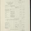
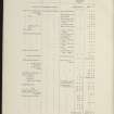
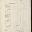
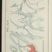
A township comprising nineteen unroofed buildings, four of which are subdivided, one of these being a long building and another T-shaped, three partially roofed buildings, one of which is a long building, ten enclosures and a system of head-dykes, which is partially shared with the farmstead to the W (NR34SW 56), depicted on the OS 1st edition 6-inch map (Argyllshire 1882, sheet ccxxxix). Four unroofed buildings, one partially roofed building, one roofed building, one enclosure, a sheepfold and the head-dyke system are shown on the current edition of the OS 1:10000 map (1981).
Information from RCAHMS (SAH) 9 December 1998

