
Tor Na Cloinne


Building(S) (Period Unassigned)
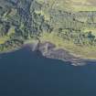
Site Name Tor Na Cloinne
Classification Building(S) (Period Unassigned)
Canmore ID 152110
Site Number NM54NE 13
NGR NM 581 496
Datum OSGB36 - NGR
Permalink http://canmore.org.uk/site/152110

- Council Highland
- Parish Morvern
- Former Region Highland
- Former District Lochaber
- Former County Argyll
NM54NE 13 581 496
One unroofed building is depicted on the 1st edition of the OS 6-inch map (Argyllshire, Island of Mull 1880, sheet liii). An unroofed building is also shown on the current edition of the OS 1:10000 map (1976), but it is located approximately 10m to the N of that shown on the 1st edition.
Information from RCAHMS (SAH) 22 June 1998

