
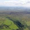
Braid Fell


Bombing Range Marker (20th Century), Bombing Target (20th Century)
Site Name Braid Fell
Classification Bombing Range Marker (20th Century), Bombing Target (20th Century)
Canmore ID 143750
Site Number NX16NW 110
NGR NX 10279 65700
NGR Description NX 10279 65700 and NX 10300 65617
Datum OSGB36 - NGR
Permalink http://canmore.org.uk/site/143750


- Council Dumfries And Galloway
- Parish Inch
- Former Region Dumfries And Galloway
- Former District Wigtown
- Former County Wigtownshire
NX16NW 110.00 10279 65700 and NX 10300 65617
See also NX16NW 111
NX16NW 110.01 NX 10891 66764 and NX 10872 66779 Bombing Target marker
A bombing target wall is situated immediately to the N of a modern barn on the W side of the single track road that goes over Braid Fell. Constructed of concrete, it has many holes and also shows splinter damage. At NX 1030 6562 at the side of the road, is a concrete direction arrow. A team of army personnel have been removing unexploded ordnance for some years and they expect to be there for a further nine years. This site is connected with that at NX16NW 111.
J A Guy 1999; NMRS MS 810/6, 206 (vol.1); 11, (Vol.2)
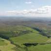
A large reinforced concrete and steel wall is situated about 200m N of a cattle grid on the minor road to Penwhirn Filter Station and Dunnerum. The wall forms part of a group of structures (see NX16NW 110.01 and NX16NW 111) used as bombing targets during World War II. The concrete direction arrow (NX 10300 65617) is adjacent to the road about 140m SE of the wall. The wall itself extends from NX 10262 65705 to NX 10296 65696.
The wall has at least four large holes in it with two of them showing evidence of having been repaired. Within the damaged area the steel reinforcing has been revealed.
The wall and arrow are visible on a postwar RAF vertical air photograph (106G/UK 987, 4175, flown 9 November 1945).
Visited by RCAHMS (DE), March 2004

