
Glenbanchor


Corn Drying Kiln (Post Medieval), Head Dyke (Post Medieval), Lime Kiln (18th Century) - (19th Century)(Possible), Township (Post Medieval)
Site Name Glenbanchor
Classification Corn Drying Kiln (Post Medieval), Head Dyke (Post Medieval), Lime Kiln (18th Century) - (19th Century)(Possible), Township (Post Medieval)
Canmore ID 138401
Site Number NN69NE 3.01
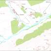
NGR NN 6782 9960
Datum OSGB36 - NGR
Permalink http://canmore.org.uk/site/138401


- Council Highland
- Parish Kingussie And Insh
- Former Region Highland
- Former District Badenoch And Strathspey
- Former County Inverness-shire
Field Visit (21 November 1995)
NN69NE 3.01 6782 9960
This township comprises thirty buildings, one possible limekiln, a kiln-barn, several enclosures, and a head-dyke. Two phases may be identified among the buildings, the later ones constructed with faced-rubble walls, often still standng to as much as 1m high, and the earlier ones reduced to grass-grown footings; the latter are situated mainly to the NW. Most of the later buildings are depicted as roofed on the 1st edition OS 6-inch map (Inverness-shire 1872, sheet ci), while most of the earlier ones are not depicted at all. Three farmsteads can be identified amongst the later buildings distinguished by the presence of enclosures adjacent to two buildings at right angles to one another. This suggests some specialisation of building-function, as opposed to the traditional long-house.
The later buildings (KING95 660-1, 663, 667-670, 672, 677-8, 718-9, 723, 755) range in size from 4.1m to 14m in length by between 2m and 3.6m in breadth within stone walls, 0.65m to 1.1m thick and up to 1m in height. The walls of seven are over 0.5m high (KING95 663, 668, 677-8, 718-9, 755), and some are constructed with quarried stone (e.g. KING95 669-670, 677-8). The majority are aligned NE and SW, with an entrance on the SE, but three are aligned NW and SE, have opposed entrances and may be barns (KING95 663, 670, 677). Indeed there is a row of stack stands on the NE of one of them (KING95 677). Two buildings are divided into two compartments (KING95 668, 669), and a third has a cartshed at one end and an outshot at the other (KING95 719). Two display traces of fireplaces (KING95 669, 678), and another two have midden scoops immediately in front, which may indicate their use as byres (KING95 667, 668).
The earlier buildings (KING95 662, 664-666, 673-676, 720-722, 751-54, 756) have a slightly wider range of size at between 3m to 18m in length. The walls are of faced-rubble and stand to a maximum of 0.4m in height. Because of their more reduced condition, fewer characteristics may be discerned. One has a midden scoop in front of it (KING95 673), another has a curved recess or flue in its SW end, 1m in diameter, which may the remains of a chimney (KING95 752), and a third has a recess at the end of one side, which may be a bedneuk measuring about 1.8m square (KING95 666).
Two kilns were identified (KING95 757, 671). One of them, which is set into the slope of the river terrace about 120m N of the township buildings (KING95 757), may be a limekiln and measures 2.4m in diameter. The second is a traditional kiln-barn (KING95 671), with a kiln 1.6m in diameter, set into the S end of a knoll to the SE of the township, and the foundations of the barn extending 2.6m to the SW.
The grassland to the E of the buildings displays the faint signs of rig, which has been almost levelled by recent cultivation. The fragmentary remains of an earthen head-dyke surround this area to the N, W and E, defining an area measuring about 200m from SW to NE by 970m transversely, including all the ground as far as the edge of the river-terrace to the S and W. To the SE of the track that runs across the middle of the cultivated ground from NE to SW, there is an earthen-banked field, measuring about 220m from NW to SE by about 130m transversely.
West Glenbanchor is depicted on the 1st edition OS 6-inch map with fourteen buildings, of which twelve were roofed buildings (KING95 660-1, 663, 667-670, 677-8, 718-9, 755), one partly roofed (recorded as a building and enclosure KING95 723) and one unroofed (KING95 672). Five enclosures and a head-dyke are also shown (Inverness-shire 1872, sheet ci). (KING95 660-678, 718-723, 751-7)
Visited by RCAHMS (PJD) 21 November 1995

