
Cnoc A' Chaisteil


Motte (Medieval)
Site Name Cnoc A' Chaisteil
Classification Motte (Medieval)
Alternative Name(s) Alness
Canmore ID 13682
Site Number NH66NW 6
NGR NH 64996 69096
Datum OSGB36 - NGR
Permalink http://canmore.org.uk/site/13682


- Council Highland
- Parish Alness
- Former Region Highland
- Former District Ross And Cromarty
- Former County Ross And Cromarty
NH66NW 6 6499 6909.
(NH 6499 6909) Cnoc a' Chaisteil (NR)
OS 25" map, (1968)
An artificial mound, traditionally the site of an ancient castle of which nothing remains.
Name Book 1874.
A motte, still known locally as Cnoc a' Chaisteil, situated on the brink of a natural escarpment.
It comprises a sub-circular area, measuring about 27.0m in diameter, which is defended in the S and E by natural slopes and elsewhere by a crescentic ditch with outer bank. Where best preserved in the N, the ditch is c.7.0m wide and c.2.0m deep and the outer bank is c.4.0m wide and c.0.4m high. The interior is mainly original ground surface, supplemented in the N and W arcs by upcast from the ditch to form a level area. Around the N arc of the interior, about 3.0 to 4.0m from the inner rim of the ditch is a curving mutilated bank, possibly a recent tree ring, c.2.5m wide and 0.4m high, truncated at each end by quarrying, which has also mutilated much of the perimeter of the motte, and destroyed the ditch and outer bank in the W. The entrance is not evident.
Re-surveyed at 1:2500.
Visited by OS (N K B) 30 October 1970.
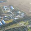
Site has been completely destroyed by quarrying activities.
Information from OS (Inverness office) to OS archaeol section.
The site was excavated in June in advance of sand and gravel extraction. The enclosure measured c.32m NS by c.29m EW and was defended on the N and NW sides by two banks and a ditch. The W half of the defences and the causeway entrance have been all but destroyed by relatively recent gravel quarrying. The entrance was originally c.3.5m wide. On the E half the defences were sectioned where they were best preserved. The ditch, c.7.5m wide and c.2.4m deep, was V-sectioned with a noticeable steepeni ng at the bottom. The external bank was c.4.5m wide and survived to a height of c.0.5m over a well preserved old land surface. The inner bank was c6.0m wide and c.0.3m high but had been damaged by quarrying for a modern plantation boundary. Within the enclosed area several postholes and small pits were discovered, mostly in the E half; they appeared to form no coherent pattern. To the E of the entrance a large pit, containing burnt soil and charcoal, had been cut into the partly filled ditch terminal. Among the few finds recovered was one sherd of medieval pottery found in the upper fill of the ditch. The large pit produced heavily corroded pieces of iron. Sponsor: SDD(AM).
J Rideout 1983.
The excavation archive from Cnoc A'Chasteil has been catalogued. Some of the photographic archive is missing.
Historic Scotland Archive Project (SW) 2002.
Note (1979)
Alness NH 649 690 NH66NW 6
Cnoc a' Chaisteil, an artificial mound about 27m in diameter, may be a motte; it is accompanied, on the N and W, by a ditch and outer bank.
RCAHMS 1979
(Name Book, Ross-shire, no. 2, p. 85)
Excavation (1983)
The site was excavated in June in advance of sand and gravel extraction. The enclosure measured c.32m NS by c.29m EW and was defended on the N and NW sides by two banks and a ditch. The W half of the defences and the causeway entrance have been all but destroyed by relatively recent gravel quarrying. The entrance was originally c.3.5m wide. On the E half the defences were sectioned where they were best preserved. The ditch, c.7.5m wide and c.2.4m deep, was V-sectioned with a noticeable steepeni ng at the bottom. The external bank was c.4.5m wide and survived to a height of c.0.5m over a well preserved old land surface. The inner bank was c6.0m wide and c.0.3m high but had been damaged by quarrying for a modern plantation boundary. Within the enclosed area several postholes and small pits were discovered, mostly in the E half; they appeared to form no coherent pattern. To the E of the entrance a large pit, containing burnt soil and charcoal, had been cut into the partly filled ditch terminal. Among the few finds recovered was one sherd of medieval pottery found in the upper fill of the ditch. The large pit produced heavily corroded pieces of iron. Sponsor: SDD(AM).
J Rideout 1983.

