
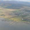
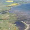
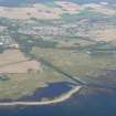
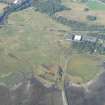
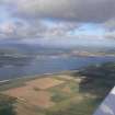
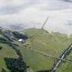
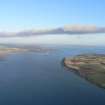
Dalmore, Dalmore Pier


Harbour (Period Unassigned)(Possible), Pier (First World War)
Site Name Dalmore, Dalmore Pier
Classification Harbour (Period Unassigned)(Possible), Pier (First World War)
Alternative Name(s) Alness Pier; Dalmore Pier; Yankee Pier
Canmore ID 13641
Site Number NH66NE 36
NGR NH 6636 6819
Datum OSGB36 - NGR
Permalink http://canmore.org.uk/site/13641


- Council Highland
- Parish Rosskeen
- Former Region Highland
- Former District Ross And Cromarty
- Former County Ross And Cromarty
NH66NE 36 6636 6819
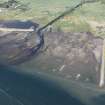
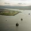
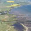
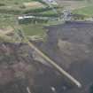
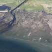
Harbour (possible); Alness Pier.
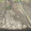
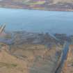
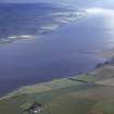
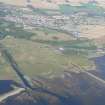
Some storm erosion and redeposition at eastern end of harbour area and silting up of mooring area to create salt marsh flats. The rest of this complex appears stable.
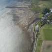
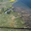
Western side of pier completely refurbished with rubble dump (erosion protection) - wired baseket stone walling. End of pier undermined by erosion. Side has been re-surfaced and drainage added.
CFA/MORA Coastal Assessment Survey 1998.
Note (5 August 2013)
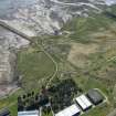
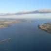
Dalmore Pier, known locally as Yankee Pier was said to have been built by the US navy in 1917-19 as part of the Submarine Mining base (US Naval Bse 17) based at Dalmore Distillery.
Information from RCAHMS (AKK) 5 August 2013

