
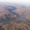
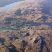
Lewis, Eishken


Head Dyke (Post Medieval), Township (Period Unassigned)
Site Name Lewis, Eishken
Classification Head Dyke (Post Medieval), Township (Period Unassigned)
Alternative Name(s) Isginn
Canmore ID 134153
Site Number NB31SW 9
NGR NB 3259 1189
NGR Description centred on NB 3259 1189
Datum OSGB36 - NGR
Permalink http://canmore.org.uk/site/134153


- Council Western Isles
- Parish Lochs
- Former Region Western Isles Islands Area
- Former District Western Isles
- Former County Ross And Cromarty
Note
A township comprising one roofed, sixteen unroofed buildings, which are annotated as Ruins, two enclosures, one of which has three compartments and is annotated as Fangs, and what may be two phases of head-dyke is depicted on the 1st edition of the OS 6-inch map (Ross-shire, Island of Lewis 1855, sheet 42). Ten roofed, two partially roofed buildings, five enclosures and the fragmentary remains of the head-dyke are shown on the current edition of the OS 1:10000 map (1972).
Information from RCAHMS (SAH) 27 June 1997

