
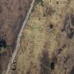
Drumashie Moor


Field System (Period Unassigned), Hut Circle(S) (Prehistoric)
Site Name Drumashie Moor
Classification Field System (Period Unassigned), Hut Circle(S) (Prehistoric)
Canmore ID 13176
Site Number NH63NW 25
NGR NH 631 360
Datum OSGB36 - NGR
Permalink http://canmore.org.uk/site/13176


- Council Highland
- Parish Dores
- Former Region Highland
- Former District Inverness
- Former County Inverness-shire
NH63NW 25 631 360.
Centred at NH 631 360 on an undulating SE-facing hillside, is a settlement of three stone-walled huts (A - C) and an associated field system. (All measurements of huts are given between wall centres.)
Hut 'A' measures c. 11.0m in diameter with a wall spread to c. 2.0m all round. Only one outer facing stone is visible, in the S arc. The simple entrance in the E arc is mutilated.
'B' measures c. 13.0m NW-SE by c. 11.5m with a wall spread to c. 3.0m all round. No entrance can be seen.
'C' is c. 12.0m in diameter with a wall spread to c. 2.5m all round. Several outer facing stones are evident in the NE. Flanking the N side of the simple, mutilated entrance in the SE arc is a prostrate slab, possibly a portal stone, measuring 1.2m by 0.8m.
The field system is comprised mainly of ruined field walls, and occasional stone clearance heaps and lynchets, but details of cultivation plots have been obscured by previous afforestation.
Surveyed at 1:10,000. (Visible on OS air photograph 67.198.037.)
Visited by OS (N K B) 17 April 1970.

