
Strath Sgitheach


Enclosure (Period Unassigned)
Site Name Strath Sgitheach
Classification Enclosure (Period Unassigned)
Canmore ID 12938
Site Number NH56SW 27
NGR NH 5255 6357
Datum OSGB36 - NGR
Permalink http://canmore.org.uk/site/12938


- Council Highland
- Parish Dingwall
- Former Region Highland
- Former District Ross And Cromarty
- Former County Ross And Cromarty
NH56SW 27 5255 6357
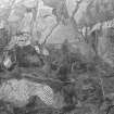
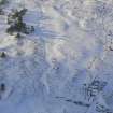
A large oval enclosure which is overlain by the field banks which are shown on the OS map. This is very ruinous and in places appears to have been robbed. At NH 5250 6357, incorporated into the circuit of the enclosure is a U-shaped feature measuring c. 10.0 by 10.0m. It would appear to be an integral part of the enclosure. Its function is unknown. Visited June 1989.
Information from S T Driscoll and S M Foster (Mss, 4, No. 2.0) 1989.
Project (June 1989)
Pre-afforestation archaeological survey undertaken in Strath Sgitheach, funded by HBM SDD.
S T Driscoll and S M Foster, 1989.

