
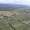
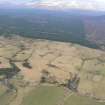
Heights Of Brae


Farmstead (Post Medieval)
Site Name Heights Of Brae
Classification Farmstead (Post Medieval)
Canmore ID 12935
Site Number NH56SW 24
NGR NH 51202 61130
Datum OSGB36 - NGR
Permalink http://canmore.org.uk/site/12935


- Council Highland
- Parish Fodderty
- Former Region Highland
- Former District Ross And Cromarty
- Former County Ross And Cromarty
Field Visit (September 1978)
Heights of Brae 3 NH512 611 NH56SW
The fragmentary remains of this deserted farm of clay-mortar construction are visible in a modern clearance-heap.
RCAHMS 1979, visited September 1978.

