
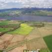
Drummondreach


Dun (Prehistoric)
Site Name Drummondreach
Classification Dun (Prehistoric)
Canmore ID 12777
Site Number NH55NE 6
NGR NH 58164 57564
Datum OSGB36 - NGR
Permalink http://canmore.org.uk/site/12777


- Council Highland
- Parish Urquhart And Logie Wester
- Former Region Highland
- Former District Ross And Cromarty
- Former County Ross And Cromarty
NH55NE 6 5817 5756.
(NH 5817 5756) Fort (NR) (Supposed)
OS 6" map, Ross-shire, 2nd ed., (1907)
Fort, Drummondreoch: An irregular area c.54' in diameter is surrounded by a stone wall. Built on two raised terraces which may be partly artificial, at the edge of a steep drop to the Castle Burn. There are two gaps in the wall, but only the S entrance seems original.
A A Woodham 1956
A robbed dun, sub-circular on plan, on the NE brink of a gully and in a wood. It measures c. 20.0m WNW-ESE by c. 18.0m between the centres of a denuded stone wall spread to c. 3.5m. No wall faces are evident. The wall has been destroyed by quarrying in the SW and the entrance is not evident.
The dun is defended in the E, N and W by two curving ditches with medial rampart, all in a poor state of preservation except where they terminate on the gully. Here the ditches are about 8.0m wide, and the rampart about 6.0m wide. The entrance through the outer defences may have been in the E, where there appears to be an access path round the wall of the dun.
The outworks have been mutilated by a track in the NW, probably to facilitate robbing.
Surveyed at 1:2500. (Visited by OS (N K B) 19 January 1965)
Visited by OS (R L) 1 December 1970
This has been a desk assessment area.
J Wordsworth, SSSIs, Scottish Natural Heritage, 1993.
Field Visit (July 1979)
Drummondreach NH 581 575 NH55NE 6
A roughly circular dun, measuring about 18m in diameter within the wasted remains of a stone wall, stands 400m E of Drummondreach farmhouse; there may have been an entrance on the S. The dun is accompanied, on the N and E, by an outwork comprising two ditches and a medial bank.
RCAHMS 1979, visited July 1979
Woodham 1956, 83, no. 49

