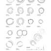
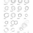
Creag An Sgor
Ring Ditch House(S) (Prehistoric)
Site Name Creag An Sgor
Classification Ring Ditch House(S) (Prehistoric)
Alternative Name(s) Waulkmill Burn; Upperton
Canmore ID 126598
Site Number NJ31NE 15
NGR NJ 37056 18530
NGR Description NJ 37040 18518 and NJ 37072 18545
Datum OSGB36 - NGR
Permalink http://canmore.org.uk/site/126598
- Council Aberdeenshire
- Parish Glenbuchat
- Former Region Grampian
- Former District Gordon
- Former County Aberdeenshire
NJ31NE 15 3704 1852 and 3706 1854
See also NJ31NE 81 and NJ31NE 125.
A pair of ring-ditch houses is situated in heather moorland on the lowermost slopes of Creag an Sgor. The NE house measures about 8.6m in diameter within a wall reduced to a thick stony bank, and there is an entrance on the S. On the NW the bank measures up to 2.2m in thickness and 0.4m in height, but where both inner and outer facing-stones are present on the W, the original thickness of the wall is about 1m. A number of outer facing-stones are also visible on the SE. and, In the SW half of the interior, a ditch up to 2.9m in breadth and 0.2m in depth is visible immediately within the line of the wall.
The SW house, which lies 26.5m from the first, measures 7.1m in diameter within a bank up to 2.5m in thickness and 0.2m in height, and there is an entrance on the S. Immediately within the interior a concentric ditch, measuring up to 2.2m in breadth and 0.15m in depth, extends from a point on the NE around the S to a point on the W.
Visited by RCAHMS (JRS, ATW), 14 May 1997.
Scheduled (with NJ31NE 81) as 'Upperton, ring-ditches 735m, 775m, 875m, 995m and 1095m NE of... a group of five ring-ditch gouses... visible as upstanding features strung out along the southern lower slopes of Creag an Sgor. The easternmost house [plotted at NJ 3740 1868] measures 8m in diameter within a stony bank up to 1.5m in thickness within a stony bank up to 1.5m in thickness and 0.3m in height. The next house [plotted at NJ 3725 1869] is 140m W and downslope of the former. It measures 9m in diameter within a wall reduced to a stone bank up to 1.5m in thickness and 0.2m in height. About 125m to the SE [plotted at NJ 3717 1861] is situated the third ring-ditch and about 110m SE from the third house there are a pair of ring-ditches 26m apart. The NE house [plotted at NJ 3707 1854] measures 8.6m in diameter within a wall reduced to a thick stony bank. On the NW the bank measures up to 2.2m in thickness and 0.4m in height, but where both inner and outer facing-stones are present on the W, the original thickness of the wall is 1m. The SW house [plotted at NJ 3704 1851] measures 7.1m in diameter within a bank up tp 2.5m in thickness and 0.2m in height.' [The locations cited are derived from the plan attached to the scheduling document. Historic Scotland appear to recognise a further ring-ditch at NJ 3717 1861, between the pairs recorded as NJ31NE 15 and NJ31NE 81 : this is entered as NJ31NE 125].
Information from Historic Scotland, scheduling document dated 22 September 2007.


