
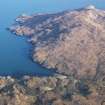
South Uist, Molatuath


Township (Period Unassigned)
Site Name South Uist, Molatuath
Classification Township (Period Unassigned)
Canmore ID 126053
Site Number NF83NE 6
NGR NF 856 352
NGR Description Centred NF 856 352
Datum OSGB36 - NGR
Permalink http://canmore.org.uk/site/126053


- Council Western Isles
- Parish South Uist
- Former Region Western Isles Islands Area
- Former District Western Isles
- Former County Inverness-shire
Note
A township comprising two roofed, two partially roofed, three unroofed buildings and four enclosures is depicted on the 1st edition of the OS 6-inch map (Inverness-shire, Hebrides, South Uist etc. 1881, sheet li). One roofed, four unroofed buildings and an enclosure are shown on the current edition of the OS 1:10000 map (1970).
Information from RCAHMS (SAH) 16 May 1997.

