Blar Na Pairce
Battle Site (15th Century)
Site Name Blar Na Pairce
Classification Battle Site (15th Century)
Canmore ID 12468
Site Number NH45NE 8
NGR NH 4732 5690
Datum OSGB36 - NGR
Permalink http://canmore.org.uk/site/12468
- Council Highland
- Parish Contin
- Former Region Highland
- Former District Ross And Cromarty
- Former County Ross And Cromarty
NH45NE 8 4732 5690.
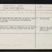
(Name Centred NH 4732 5690) Blar na Pairce. Site of conflict between the Macdonalds and MacKenzies about A.D.1490 {NAT}
OS 6"map, Ross-shire, 2nd ed., 1907
The Macdonalds fought the MacKenzies at the battle of the Park near Loch Kinellan, between 1485 and 1491.
H A Fraser 1917
No further information
Visited by OS (R L) 16 November 1970
Metal Detector Survey
NH 4732 5690 An evaluation consisting of a desk-based assessment and metal detecting survey was carried out in advance of construction of a forestry access road adjacent to the traditional site of the Battle of Blar na Pairce, 1491. Historical accounts indicate that the battle took place where the MacDonald forces were caught in a bog and this appears to be confirmed by the topography of the site. No metal finds contemporary with the battle were recovered through metal detecting; any objects dropped in the bog are likely to have sunk too deep to be detected. Iron parts of agricultural implements dating to the 19th and 20th century were recovered from the adjacent improved field.
Funder: Mary MacDougall.


