
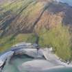
Berneray, Ruisgarry


Farmstead (Period Unassigned)
Site Name Berneray, Ruisgarry
Classification Farmstead (Period Unassigned)
Alternative Name(s) Besdarra
Canmore ID 123228
Site Number NF98SW 32.05
NGR NF 9314 8244
Datum OSGB36 - NGR
Permalink http://canmore.org.uk/site/123228

- Council Western Isles
- Parish Harris
- Former Region Western Isles Islands Area
- Former District Western Isles
- Former County Inverness-shire
Note
A farmstead comprising four roofed buildings and an enclosure is depicted on the 1st edition of the OS 6-inch map (Inverness-shire, Hebrides, Harris, North Uist etc 1880, sheet xxvi). One unroofed, three roofed buildings and an enclosure are shown on the current edition of the OS 1:10000 map (1971).
Information from RCAHMS (SAH) 7 April 1997.

