
Pricing Change
New pricing for orders of material from this site will come into place shortly. Charges for supply of digital images, digitisation on demand, prints and licensing will be altered.
Cnoc Achadh Na H-uaighe


Cairnfield (Period Unknown)
Site Name Cnoc Achadh Na H-uaighe
Classification Cairnfield (Period Unknown)
Canmore ID 122696
Site Number NC70NW 134
NGR NC 7228 0704
Datum OSGB36 - NGR
Permalink http://canmore.org.uk/site/122696


- Council Highland
- Parish Rogart
- Former Region Highland
- Former District Sutherland
- Former County Sutherland
Field Visit (20 March 1995)
NC70NW 134 7228 0704
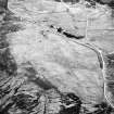
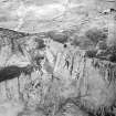
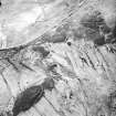
There are four small cairns, measuring up to 4m in diameter and 0.3m in height, on a well-drained knoll rising out of the otherwise boggy ground in the saddle to the SE of Cnoc Achadh na h-Uaighe.
(ROG95 987)
Visited by RCAHMS (DCC) 20 March 1995

