
Cnoc Achadh Na H-uaighe


Hut Circle(S) (Prehistoric)
Site Name Cnoc Achadh Na H-uaighe
Classification Hut Circle(S) (Prehistoric)
Canmore ID 122372
Site Number NC70NW 2.02
NGR NC 7165 0740
NGR Description NC 7165 0740 and NC 7167 0737
Datum OSGB36 - NGR
Permalink http://canmore.org.uk/site/122372

- Council Highland
- Parish Rogart
- Former Region Highland
- Former District Sutherland
- Former County Sutherland
Field Visit (6 April 1981)
NC70NW 2.02 7165 0740 and 7167 0737
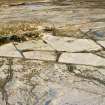
On the W flank of Cnoc Achadh na h-Vaighe is a settlement of three hut circles (A-C) one (A) with a souterrain, and an accompanying well-preserved field system. 'B' and 'C' are very similar but lack the rubust construction of hut 'A'. They are heather covered, and measure respectively 13.0 by 12.0m and 14.0 by 13.0m within obscure wall spreads; entrances are in the S, the line of the long axis in both cases. A mound abuts the NW interior of hut C.
Revised at 1:10,000.
Visited by OS (J M) 6 April 1981.
Field Visit (9 March 1995)
NC70NW 2.02 7165 0740 and 7167 0737
Two hut-circles, first identified by the OS, are levelled into a sloping terrace on the SW-facing flank of the hill. They measure 12m by 11.7m (ROG95 43, NC 7165 0740, OS ?B?) and 13.5m by 13m (ROG95 44, NC 7167 0737, OS ?C?) within heather-covered banks spread to 2m in thickness and 0.4m in height. The terminals of the banks have been expanded on either side of the entrances, which lie on the SSE.
(ROG95 43, 44)
Visited by RCAHMS (DCC) 9 March 1995

