
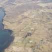
Skye, Upper Milovaig


Head Dyke (Post Medieval), Township (Period Unassigned)
Site Name Skye, Upper Milovaig
Classification Head Dyke (Post Medieval), Township (Period Unassigned)
Canmore ID 119429
Site Number NG14NE 29
NGR NG 156 495
NGR Description Centred NG 156 495
Datum OSGB36 - NGR
Permalink http://canmore.org.uk/site/119429

- Council Highland
- Parish Duirinish
- Former Region Highland
- Former District Skye And Lochalsh
- Former County Inverness-shire
Note
A crofting township, comprising thirty-six roofed, twelve unroofed buildings and a head-dyke is depicted on the 1st edition of the OS 6-inch map (Inverness-shire, Isle of Skye 1881, sheet xx). Twenty-six roofed, eighteen unroofed buildings and the head-dyke are shown on the current edition of the OS 1:10560 map (1968).
Information from RCAHMS (AKK) 22 October 1996.

