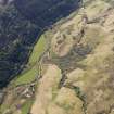
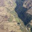
Torran A'chleibh
Hut Circle (Prehistoric)
Site Name Torran A'chleibh
Classification Hut Circle (Prehistoric)
Canmore ID 11795
Site Number NG81NW 4
NGR NG 8380 1730
Datum OSGB36 - NGR
Permalink http://canmore.org.uk/site/11795
- Council Highland
- Parish Glenelg (Skye And Lochalsh)
- Former Region Highland
- Former District Skye And Lochalsh
- Former County Inverness-shire
NG81NW 4 8380 1730.
(Area: NG 838 174). A fragmentary and grass-grown circle of stones is situated between Glenelg and Glen Beag at about 500' OD and just E of Correry Farm, and Dun Trotan. It has an internal diameter of c. 30' with a wall 5' thick. Some of the stones are large.
L Bogle 1895.
This is a circular stone-walled house in a poor state of preservation at NG 8380 1730.
It is visible as a platform set into a SW-facing slope, surrounded by a mutilated wall measuring 10.0m between its centres. Entrance not evident.
Surveyed at 1/2500.
Visited by OS (A A) 26 June 1974.


