
Culantuim


Farmstead (Period Unassigned)
Site Name Culantuim
Classification Farmstead (Period Unassigned)
Alternative Name(s) Culantuin
Canmore ID 117673
Site Number NJ21NW 24
NGR NJ 2273 1998
Datum OSGB36 - NGR
Permalink http://canmore.org.uk/site/117673


- Council Moray
- Parish Inveravon
- Former Region Grampian
- Former District Moray
- Former County Banffshire
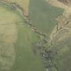
The ruins of a rectangular building have been identified in coniferous woodland at Culantuim, on the north-west bank of Allt na Fanich, near Tom a'Lienam
The 1st edition of the Ordnance Survey 6-inch map of Banffshire, surveyed in 1872, shows that at that time Culantuim consisted of four rectangular buildings, all roofed, and presumably occupied. On the 1972 1:10000 map showing this same area, only two of these structures were still roofed.
Text prepared by RCAHMS as part of the Accessing Scotland's Past project
NJ21NW 24 2273 1998
The remains of a two-compartmented house have been recorded in coniferous woodland on a SW-facing slope at an altitude of 398m OD.
Information from Aberdeenshire Archaeological Service, 4 February 1997.
NMRS, MS/712/14.
The following site has been identified while checking maps and vertical aerial photographs held by Aberdeenshire Archaeology Service, who provide an archaeological service for Moray Council. Full information is held in the archaeological SMR.
Culantuim (Inveravon parish)
NJ 227 199 Remains of two-compartmented house.
Sponsor: Moray Council.
M Greig 1997

