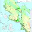
Garvie Bay
Bank (Earthwork) (Post Medieval), Building (Post Medieval), Hut Circle (Prehistoric), Kelp Kiln (Post Medieval), Lazy Beds (Post Medieval), Weir (Post Medieval)
Site Name Garvie Bay
Classification Bank (Earthwork) (Post Medieval), Building (Post Medieval), Hut Circle (Prehistoric), Kelp Kiln (Post Medieval), Lazy Beds (Post Medieval), Weir (Post Medieval)
Canmore ID 116396
Site Number NC01SW 27
NGR NC 0390 1370
Datum OSGB36 - NGR
Permalink http://canmore.org.uk/site/116396
- Council Highland
- Parish Lochbroom
- Former Region Highland
- Former District Ross And Cromarty
- Former County Ross And Cromarty
Field Visit
NC01SW 27 0390 1370
There is a hut-circle, a rectangular building, and two small areas of lazy-bed cultivation on the W side of Garvie Bay, about 200m WNW of the outfall from Loch Garvie. The hut-circle measures 10.4m NE-SW by 9.4m transversely within a bank 0.6m high and spread to 1.6m in thickness in which some inner-facing stones are visible (ACHIL94 465). The building (ACHIL94 466) overlies the N arc of the hut-circle wall. It is rectangular, built of faced-rubble with squared corners, and measures internally 6.2m NNW-SSE by 3m transversely. The walls are 0.6m thick and survive to a height of 0.5m. The entrance is in the WNW side.
On the gently-sloping ground around these two structures there are lazy-beds covering about 0.3ha, and a short distance to the SE, on the N shore of Loch Garvie at NC 0393 1366, there is another area of lazy-beds, extending to about 0.2ha. Passing between these two cultivated areas there is a bank which runs SW from the shore for about 140m before fading into boggy ground at NC 0382 1360.
(ACHIL94 465-6)
Visited by RCAHMS (SDB) 10 August 1994
Site recorded during a survey of the intertidal zone and the coast edge (50m from the mean high tide mark) between the Rivers Ullapool and Culag.
Further details can be found in a report submitted to Historic Scotland.
NC 039 137 Circular kelp kiln, structure, weir.
Sponsors: Historic Scotland, Glasgow University Archaeology Department.
A Long 1996


