
Niag-ard


Township (Period Unassigned)
Site Name Niag-ard
Classification Township (Period Unassigned)
Canmore ID 11623
Site Number NG70NW 3
NGR NG 744 069
Datum OSGB36 - NGR
Permalink http://canmore.org.uk/site/11623


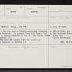
- Council Highland
- Parish Glenelg (Lochaber)
- Former Region Highland
- Former District Lochaber
- Former County Inverness-shire
NG70NW 3 744 069.
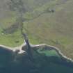
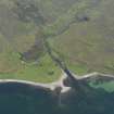
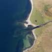
(Area: NG 744069) Niag - ard (NAT)
OS 6"map, Inverness-shire, 2nd ed., (1902)
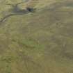
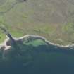
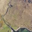
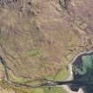
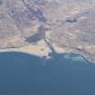
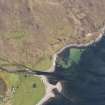
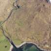
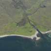
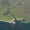
Niag - ard was once a thickly populated district, but is now deserted. It extends from Allt Niag - ard on the W to Amhain Ghuserin on the E. The HWM forms the N boundary.
Name Book 1873.
In 1849 over 500 people left the parish of Glenelg to emigrate to Canada.
A Mackenzie 1883.
By-passed - difficult access
OS surveyor, October 1966.
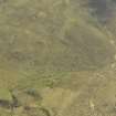
A township, comprising twenty-seven unroofed buildings and one enclosure is depicted on the 1st edition of the OS 6-inch map (Inverness-shire 1876, sheet lxxvi). Thirty unroofed buildings, three enclosures and some short lengths of field-wall are shown on the current edition of the OS 1:10000 map (1970).
Information from RCAHMS (AKK) 29 July 1996.

