Achlochan
Building(S) (Post Medieval), Clearance Cairn (Post Medieval), Farmstead (Post Medieval), House (19th Century) - (20th Century), Hut(S) (Post Medieval), Lazy Beds (Post Medieval), Stack Yard (Post Medieval)
Site Name Achlochan
Classification Building(S) (Post Medieval), Clearance Cairn (Post Medieval), Farmstead (Post Medieval), House (19th Century) - (20th Century), Hut(S) (Post Medieval), Lazy Beds (Post Medieval), Stack Yard (Post Medieval)
Canmore ID 115656
Site Number NC00NW 60
NGR NC 0248 0703
Datum OSGB36 - NGR
Permalink http://canmore.org.uk/site/115656
- Council Highland
- Parish Lochbroom
- Former Region Highland
- Former District Ross And Cromarty
- Former County Ross And Cromarty
Field Visit (20 June 1994)
NC00NW 60.00 0248 0703
NC00NW 60.01 0243 0713 Farmstead (ACHIL94 260-2)
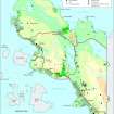
Achlochan House (NC 0248 0703) is roofed and occupied, and stands at the E edge of a block of improved fields, about 6ha in extent. The ruins of a farmstead stand 120m to the NW of the house at NC 0243 0713 (NC00NW 46.01). About 300m to the SE of the house, at the E corner of the improved ground, there are another two buildings, partly roofed and now used as outbuildings; there is a stack stand 3.5m in diameter between the two buildings and a small stackyard is attached to the W side of the NW building. To the W of these buildings there are two huts, each in an angle of the dyke enclosing the improved ground, which appears to overlie both huts. One of these huts is situated at NC 0258 0696 (ACHIL94 487). It measures 3.8m in length by 2m in breadth within the footings of a turf and stone wall and it has an entrance on the SW side. The other hut, 100m to the SE at NC 0264 0689, measures 3.8m in length by 2.3m in breadth within a turf bank 0.3m high. It has an entrance on the NE side (ACHIL94 488). Finally, to the SE of the improved ground there is an area of lazy-bed cultivation, covering about 0.6ha (centred at NC 0268 0687).
The ONB of the OS (1881) describes Achlochan as 'a hamlet consisting of three houses situated north of Polglass on the property of the Duchess of Sutherland'. The 1st edition of the OS 6-inch map (Cromartyshire 1881, sheet iii) depicts a house on the site now occupied by Achlochan House with one unroofed building immediately to the SE and another roofed building 30m to the S of this, the farmstead to the NW, and four roofed buildings, one unroofed building and three enclosures attached to the field wall surrounding the improved ground to the SE. It also appears to show one of the huts (ACHIL94 487) also roofed.
(ACHIL94 260-2; 487-8)
Visited by RCAHMS (SDB) 20 June 1994
ONB 1881


