Berriedale, Langwell Water
Structure(S) (Period Unassigned)(Possible)
Site Name Berriedale, Langwell Water
Classification Structure(S) (Period Unassigned)(Possible)
Alternative Name(s) Lat 297; Inver
Canmore ID 115405
Site Number ND12SW 62
NGR ND 117 224
Datum OSGB36 - NGR
Permalink http://canmore.org.uk/site/115405
- Council Highland
- Parish Latheron
- Former Region Highland
- Former District Caithness
- Former County Caithness
ND12SW 62 117 224
ND 118 224, Inver. A settlement of four buildings.
Roy's Map 37/1, 1747.
ND 1170 2244. Structures, Berriedale, no dimensions available. Located by OS as possibly four buildings, no trace in 1982. LAT 297.
C E Batey, Caithness Coastal Survey, 1982
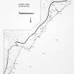
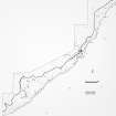
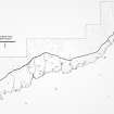
No evidence of any structures or archaeological features could be located in an area of dense woodland during the course of a pre-afforestation survey by Headland Archaeology (NMRS MS 899/93, no.1).
C Moloney and L Baker (Headland Archaeology) 13 July 1998; NMRS, MS/899/93, no. 1.
Site recorded during a survey undertaken of c 2 sq km of land either side of the Langwell Water, by Berriedale.
ND 1170 2244 ?Structures (ND12SW 62).
Sponsor: Historic Scotland
C Moloney and L Baker 1998.
Project (1980 - 1982)
Field Visit (1982)
ND 1170 2244. Structures, Berriedale, no dimensions available. Located by OS as possibly four buildings, no trace in 1982. LAT 297.
C E Batey, Caithness Coastal Survey, 1982


