
Hound Point


Pier (First World War)
Site Name Hound Point
Classification Pier (First World War)
Alternative Name(s) Inner Forth Estuary; Upper Firth Of Forth
Canmore ID 113051
Site Number NT17NE 102
NGR NT 15679 79577
NGR Description From NT 15753 79537 to NT 15579 79643
Datum OSGB36 - NGR
Permalink http://canmore.org.uk/site/113051


- Council Edinburgh, City Of
- Parish Dalmeny
- Former Region Lothian
- Former District City Of Edinburgh
- Former County West Lothian
A pier is marked as a feature labelled "wood pier" of the Hound Point Battery on a map of 1916 showing the defences of the battery (The National Archives WO 78/4396).
Information from HS/RCAHMS World War One Audit Project (GJB) 19 August 2013.
NT17NE 102 15679 79577
Site recorded during a rapid coastal survey undertaken by GUARD of the S shore of the Firth of Forth from Dunbar to Stirling and along the N shore of the Forth to the Fife border. A gazetteer of all sites including listed buildings, designed landscapes, scheduled and unscheduled monuments was produced. Full details of the survey can be consulted in the report held by the NMRS.
NT 157 795 Wooden posts, ?pier
Sponsor: Historic Scotland
GUARD 1996
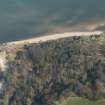
The posts are situated immediately west of Hound Point at the extreme east end of Peatdraught Bay. There are two rows of wooden posts c 3m apart, running north-south. The tallest post is c 4m high with an average diameter of c 0.25m. The wood is in a severely rotted and weathered condition. These are probably the remains of a wooden pier.
Site recorded by GUARD during the Coastal Assessment Survey for Historic Scotland, 'The Firth of Forth from Dunbar to the Coast of Fife' 17th February 1996.
Field Visit (17 February 1996)
The posts are situated immediately west of Hound Point at the extreme east end of Peatdraught Bay. There are two rows of wooden posts c 3m apart, running north-south. The tallest post is c 4m high with an average diameter of c 0.25m. The wood is in a severely rotted and weathered condition. These are probably the remains of a wooden pier.
Site recorded by GUARD during the Coastal Assessment Survey for Historic Scotland, 'The Firth of Forth from Dunbar to the Coast of Fife' 17th February 1996.
Project (March 2013 - September 2013)
A project to characterise the quantity and quality of the Scottish resource of known surviving remains of the First World War. Carried out in partnership between Historic Scotland and RCAHMS.

