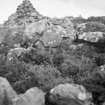
Skye, Dun Torvaig
Dun (Prehistoric)
Site Name Skye, Dun Torvaig
Classification Dun (Prehistoric)
Canmore ID 11300
Site Number NG44SE 2
NGR NG 4937 4422
Datum OSGB36 - NGR
Permalink http://canmore.org.uk/site/11300
- Council Highland
- Parish Portree
- Former Region Highland
- Former District Skye And Lochalsh
- Former County Inverness-shire
Field Visit (29 May 1921)
Dun Torvaig, near Portree.
On the rough northern slope of Ben Chracaig, some 7/8 mile north-east of Portree pier, at an elevation of 400 feet above sea-level, is Dun Torvaig, which occupies a rocky eminence rising about 35 feet above the surroundings, and only approachable over an ascending ridge from the south-west. The dun is oval on plan, with its main axis running almost north-west and south-east, along which it measures internally about 65 feet, while it is 48 feet in breadth. It has been defended by a stone wall encircling the summit of the ridge, with two outer walls across the approaching slope to the north west measuring from outer faces 27 feet and 10 feet apart respectively. The walls are very much dilapidated, but at the north-west end of the enceinte, where the wall has been strongest, the mass of stones remaining covers a width of 30 feet and rises about 6 feet in height; while a section of the outer face, about 9 feet in length and 3 feet in height, is still in position. The two outer walls seem to have been about 3 feet 6 inches thick. While both ends of the first wall and the southern end of the second give on to the rocky scarp on each side of the ridge, the north-eastern end of the latter returns along the edge of the ridge as far as the main wall. The entrance has been from the south-west, and it passes through the two outer walls near the southern side of the ridge, being walled on both sides between these defences and showing a width of about 3 feet 9 inches. Where it enters the inner defence is not apparent owing to the dilapidated condition of the wall.
RCAHMS 1928, visited 29 May 1921.
OS map: Skye xxiv
Field Visit (11 October 1971)
NG44SE 2 4937 4422.
(NG 4937 4422) Dun Torvaig (NR)
OS 6"map, (1969)
Dun Torvaig, a dun with outworks on a rocky knoll.
The dun, oval on plan measures externally 28.0m NW-SE by 18.0m transversely. The wall is 4.1m thick at the N side of the entrance which is in the W and is 1.4m wide. Except at the entrance the inner wall face is not evident, but the outer face can be traced for most of the periphery. Within the wall is a stabilising face which can also be traced for most of the periphery. Of two circular structures planned RCAHMS in the interior, the more westerly appears to be a ruinous recent structure, and the other is an amorphous scatter of stones with no structural details apparent, but possible fortuitous tumble.
The approach from the W has been blocked by two curving close-set walls of indeterminate thickness whose outer faces are well defined by blocks on edge. An entrance 1.2m wide in the SW is well defined by similar blocks.
Immediately outside the outwork in the N is a level platform, about 7.0m in diameter which although probably natural, would make an excellent hut stance.
Surveyed at 1/500.
Visited by OS (I S S) 11 October 1971.
(RCAHMS 1928)
Note (16 January 2015 - 1 June 2016)
The remains of this fortification are situated on a hillock on the W flank of Ben Chracaig, which rises up on the NE side of the bay at Portree. Rising over 10m above the surrounding ground, the summit is only easily accessible from the W, where the approach is barred by at least two strong walls to create a small promontory work. The wall of the inner enclosure has been reduced largely to a mound of rubble up to 9m in thickness by 2m in height, within which a length of the outer face of a substantial structure can be seen in the central sector. About 8m outside this wall there is a second line of defence, recorded on the RCAHMS plan drawn up in 1921 (RCAHMS 1928, 183-4, no.578, fig 261) as two concentric walls, each little more than 1m in thickness, swinging round the W flank, and the inner apparently returning back along the N flank towards the inner enclosure; these outer lines are pierced by an entrance 1.15 wide on the W close to the S margin of the hillock, but aligned NE and SW. Set only 3m apart, these are an unusual feature, and there is a possibility that, rather than being two, they represent the robbed out remains of a single massive wall. If so, this probably represents an earlier line of defence, cutting off an area measuring about 30m from NW to SE by 15m transversely (0.04ha), whereas the inner enclosure takes in an area of no more than 20m by 15m transversely (0.03ha). In essence, the latter is probably the remains of a dun inserted into an earlier fort, though there is no evidence that its wall continued round the rocky margins of the hillock. Several features are shown on the RCAHMS plan within the interior, but they are not elaborated in the description and have recieved no commentaries since.
Information from An Atlas of Hillforts of Great Britain and Ireland – 01 June 2016. Atlas of Hillforts SC2710


