
Glen Ogle, Upper Ogle Burn Bridge


Bridge (18th Century)
Site Name Glen Ogle, Upper Ogle Burn Bridge
Classification Bridge (18th Century)
Canmore ID 112432
Site Number NN52NE 14
NGR NN 56423 27392
Datum OSGB36 - NGR
Permalink http://canmore.org.uk/site/112432

- Council Stirling
- Parish Balquhidder
- Former Region Central
- Former District Stirling
- Former County Perthshire
NN52NE 14 56423 27392
See also NN52NE 12-13 and NN52NE 15.
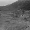
Round-ached bridge 5.0m wide on alternative line of military road (NN52NE 11.00, MR 8).
Visited by OD (WDJ) December 1968.

