
Antonine Wall, Military Way


Frontier Defence (Roman), Roman Road (Roman)
Site Name Antonine Wall, Military Way
Classification Frontier Defence (Roman), Roman Road (Roman)
Canmore ID 108953
Site Number NS77NW 49.05
NGR NS 7200 7622
NGR Description From NS 7064 7597 to NS 7395 7699
Datum OSGB36 - NGR
Permalink http://canmore.org.uk/site/108953


- Council North Lanarkshire
- Parish Cumbernauld
- Former Region Strathclyde
- Former District Cumbernauld And Kilsyth
- Former County Dunbartonshire
NS 7074 7600 to NS 7083 7600 Excavations at Bar Hill Fort (NS77NW 8) proved Military Way branched to by-pass the fort to the N. Course marked on OS record 25 inch (1931) by Macdonald (1934).
No surface trace of the Military Way was found between NS 7074 7600 to NS 7083 7600.
NS77NW 49.05 From 7064 7597 to 7395 7699
Outside the ditches of the Croy Hill Roman fort (NS77NW 10) the line of the Military Way by-pass was confirmed.
W S Hanson 1977, 1978
In the area of Croy Hill the military way follows the line of the wall but at some 50 yards distant.
R Cochrane 1906.
NS 7064 7597 to NS 7074 7600 Military Way proved during excavations at Bar Hill fort (NS77NW 8). Course marked by Macdonald on OS record 25 inch sheet (Macdonald 1934).
NS 7081 7596 to NS 7090 7600 and NS 7083 7600 to NS 7086 7599 Military Way is visible at E entrance to fort (NS77NW 8), firstly as a causeway and then bending as an agger, some 6.0m wide and 0.5m high. The line fades as it approaches forestry wall boundary. The branch to the N is not traceable; its course was plotted by macdonald on OS record 25 inch sheet. This section is under Scottish Development Department (Inspectorate of Ancient Monuments) Guardianship.
NS 7074 7600 to NS 7083 7600 Excavations at Bar Hill Fort (NS77NW 8) proved Military Way branched to by-pass the fort to the N. Course marked on OS record 25 inch (1931) by Macdonald (1934).
No surface trace of the Military Way was found between NS 7074 7600 to NS 7083 7600.
NS 7090 7600 to NS 7100 7602 Macdonald marked the course of the Military Way through this sector on OS record 25 inch sheet (1931). It was apparently extant though barely distinguishable about 1931 (Macdonald 1934).
A featureless forestry ride is on the approximate line across the area across NS 7090 7600 to NS 7100 7602.
NS 7100 7602 to NS 7175 7617 From E to W no evidence of the Military Way was found across a ploughed field, close woodland, and then, ascending the former Castle Hill park, a dense area of mature afforestation. RAF vertical aerial photographs (106G/SCOT/UK 92: frames 3086-7, 1946) show nothing significant (pre-afforestation).
NS 7105 7605 Excavations in 1957 on Macdonald's line of the Military Way proved inconclusive. On the 'presumed route' there were just a few 'trial cuttings' made in an area just NE of a circular enclosure through the N section of which Macdonald (1934) had suggested that the road passed. A gravel surface emerged in two of the small trenches, gravel again being located in a third trench situated to the n of the first two. In this trench a number of stones were discovered below the gravel, but these seemed to become thinner at the N 'end of the trench.' Beneath this was a 15cm layer of soil, and then another 'layer of hard-packed gravel covering a stone bottoming.' This layer also appeared to terminate in the trench and neither layer emerged in another trench which had been cut a little further N. It appears, therefore, that there were two roads, dug at sufficient intervals apart for a layer of soil to accumulate, but further excavation is necessary before conclusions should be drawn (Keppie and Breeze 1982).
NS 7116 7609 Macdonald marked the course of the Military Way through this sector on OS record 25 inch sheet (1931). It was apparently extant though barely distinguishable at this date, some 40ft. S of the Wall (Macdonald 1934).
NS 7175 7617 to NS 7200 7617 Published survey (OS 25 inch 1958) revised. No surface trace of the Wall or Military Wall. Macdonald's line accepted; the terrace through the cleared Girnal Hill wood was observed in 1957 (Information from OS 1957) as 0.8m high, but the area is now wasteland with dumping having obscured all trace.
NS 7192 7617 The course of the military way determined by trenching in this area in 1931. It was visible as a cut terrace through Girnal Hill wood.
NS 7208 7618 The course of the Military Way was determined by trenching on the W side of the Kilsyth Road. It is marked on the OS record 25 inch by Macdonald (1931, 1934).
NS 7297 7625 to NS 7300 7626 Published survey of Military Way as per Macdonald's annotated record 25 inch. No extant trace but the grass track referred to is the most obvious route.
NS 7300 7626 to NS 7316 7640 The twin courses of the Military Way are in places evident as a grass track, but no original agger is present.
NS 7338 7667 to NS 7388 7693 The published survey of the Military Way stands. It is mainly traceable as a grass track, but occasionally the agger, c 5.5m wide, is visible. The course as shown was established by the Glasgow Archaeological Society (1899) and Macdonald (1934), who indicated the line on OS record 25 inch (1931). RAF vertical aerial photographs (106G/SCOT/UK 92: frames 3089-90, 1946) show, in part, the line. In 1957 an OS Field Report (1957) noted that cobbling was still exposed in a Glasgow Archaeological Society trench (NS 7353 7676) across the Military Way.
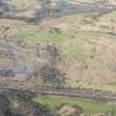
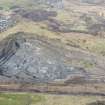
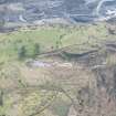
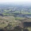
See also general RCAHMS aerial photographs DB 727-8 (1976), DB 729 (1976) and DB 738-9 (1976)
NS 7308 7632 to NS 7321 7633 Branch system of Military Way proved by excavation 1890-3 (Glasgow Archaeological Society 1899).
NS 7353 7676 One section of the Military Way was cut from 1890-3 (Glasgow Archaeological Society 1899).
NS c. 7458 7712 The remains of the Military Way, as well as the Wall, were excavated by the then Ministry of Public Buildings and Works in 1958 (Robertson 1973)
Information from OS 1980
Glasgow Archaeological Society 1899; L J F Keppie and D J Breeze 1982; G Macdonald 1934; A S Robertson 1973
The terrace of the Military Way is still visible on Girnal Hill and its metalling was located on a shelf of the hillside in Trenches 9 and 10.
S S Frere 1991
NS 718 762 As part of an archaeological assessment on a possible alignment for the proposed extension to the M80 Glasgow-Stirling motorway, geophysical survey S of the line of the Wall, itself inaccessible below a farm track, revealed a ditch running E-W, which may have flanked the Military Way, but no trace of the milefortlet long suspected hereabouts.
L J F Keppie 1995.
NS c.7219 7615 and NS c.7222 7615 Two trenches were placed across likely alignments E of Kilsyth Road. The Military Way was located in line with its course W of Kilsyth Road. It occupied a shelf in the hillside, below the summit of the knoll, and consisted mainly of small cobbles. It as edged on the N side with carefully laid medium-sized cobbles and was accompanied by a shallow drainage gully, 0.8m wide and 0.2m deep. The breadth of the road could not be established.
L J G Keppie, G B Bailey, A J Dunwell, J H McBrien, K Speller 1995.
NS 706 759 The alignments of the Wall, ditch and Military Way, on the W slope of Bar Hill, were plotted by resistivity survey in the hope of locating an interval fortlet or other installation, without result.
L J F Keppie 1996.
In 1958 remains of the military way were discovered within the grounds of Easter Dullatur House. In the area of Croy Hill it has been possible to trace the route of the military way running W from the fort (NS77NW 10) and being joined by another road which has headed N through a gap located in low hills to be found to the S. It is probable that this latter road forms the W end of a 'long loop line' which parted from the military way at a point considerably further E.
Close to the B802, which runs from Cumbernauld to Kilsyth, the military way has again been located. A little further W, on the N side of Girnal Hill, which lies to the S of the Wall, a clearly visible terrace marks the line of the military way.
A modern track which had been heading W suddenly turns to the S just before reaching an afforested area, and at this point the Military Way is visible as an open line in the forestry plantation, continuing W.
Before 'reaching the east gate of the fort,' the Military Way turns N and continues on a route between the Wall and the fort. In this section it was approximately 5m in width, had a camber and also drains on either side.
A S Robertson and L Keppie 2001.
Excavation (1890 - 1893)
NS 7308 7632 to NS 7321 7633 Branch system of Military Way proved by excavation 1890-3 (Glasgow Archaeological Society 1899).
Excavation (1890 - 1893)
NS 7353 7676 One section of the Military Way was cut from 1890-3 (Glasgow Archaeological Society 1899).
Excavation (1902 - 1905)
NS 7064 7597 to NS 7074 7600 Military Way proved during excavations at Bar Hill fort (NS77NW 8). Course marked by Macdonald on OS record 25 inch sheet (Macdonald 1934).
Field Visit (1906)
In the area of Croy Hill the military way follows the line of the wall but at some 50 yards distant.
R Cochrane 1906.
Field Visit (1931)
NS 7090 7600 to NS 7100 7602 Macdonald marked the course of the Military Way through this sector on OS record 25 inch sheet (1931). It was apparently extant though barely distinguishable about 1931 (Macdonald 1934).
Excavation (1931)
NS 7208 7618 The course of the Military Way was determined by trenching on the W side of the Kilsyth Road. It is marked on the OS record 25 inch by Macdonald (1931, 1934).
Excavation (1931)
NS 7192 7617 The course of the military way determined by trenching in this area in 1931. It was visible as a cut terrace through Girnal Hill wood.
Field Visit (1931)
NS 7116 7609 Macdonald marked the course of the Military Way through this sector on OS record 25 inch sheet (1931). It was apparently extant though barely distinguishable at this date, some 40ft. S of the Wall (Macdonald 1934).
Field Visit (1934)
NS 7081 7596 to NS 7090 7600 and NS 7083 7600 to NS 7086 7599 Military Way is visible at E entrance to fort (NS77NW 8), firstly as a causeway and then bending as an agger, some 6.0m wide and 0.5m high. The line fades as it approaches forestry wall boundary. The branch to the N is not traceable; its course was plotted by macdonald on OS record 25 inch sheet.
Publication Account (1934)
NS 7074 7600 to NS 7083 7600 Excavations at Bar Hill Fort (NS77NW 8) proved Military Way branched to by-pass the fort to the N. Course marked on OS record 25 inch (1931) by Macdonald (1934).
Excavation (29 July 1957 - 3 August 1957)
NS 7105 7605 Excavations in 1957 on Macdonald's line of the Military Way proved inconclusive. On the 'presumed route' there were just a few 'trial cuttings' made in an area just NE of a circular enclosure through the N section of which Macdonald (1934) had suggested that the road passed. A gravel surface emerged in two of the small trenches, gravel again being located in a third trench situated to the n of the first two. In this trench a number of stones were discovered below the gravel, but these seemed to become thinner at the N 'end of the trench.' Beneath this was a 15cm layer of soil, and then another 'layer of hard-packed gravel covering a stone bottoming.' This layer also appeared to terminate in the trench and neither layer emerged in another trench which had been cut a little further N. It appears, therefore, that there were two roads, dug at sufficient intervals apart for a layer of soil to accumulate, but further excavation is necessary before conclusions should be drawn (Keppie and Breeze 1982).
Field Visit (1957)
In 1957 an OS Field Report (1957) noted that cobbling was still exposed in a Glasgow Archaeological Society trench (NS 7353 7676) across the Military Way.
Excavation (1958)
NS c. 7458 7712 The remains of the Military Way, as well as the Wall, were excavated by the then Ministry of Public Buildings and Works in 1958 (Robertson 1973)
Excavation (1976 - 1978)
Outside the ditches of the Croy Hill Roman fort (NS77NW 10) the line of the Military Way by-pass was confirmed.
W S Hanson 1977, 1978
Field Visit (1980)
No surface trace of the Military Way was found between NS 7074 7600 to NS 7083 7600.
Field Visit (1980)
NS 7338 7667 to NS 7388 7693 The published survey of the Military Way stands. It is mainly traceable as a grass track, but occasionally the agger, c 5.5m wide, is visible. The course as shown was established by the Glasgow Archaeological Society (1899) and Macdonald (1934), who indicated the line on OS record 25 inch (1931). RAF vertical aerial photographs (106G/SCOT/UK 92: frames 3089-90, 1946) show, in part, the line.
Field Visit (1980)
A featureless forestry ride is on the approximate line across the area across NS 7090 7600 to NS 7100 7602.
Information from OS 1980
Field Visit (1980)
NS 7100 7602 to NS 7175 7617 From E to W no evidence of the Military Way was found across a ploughed field, close woodland, and then, ascending the former Castle Hill park, a dense area of mature afforestation. RAF vertical aerial photographs (106G/SCOT/UK 92: frames 3086-7, 1946) show nothing significant (pre-afforestation).
Information from OS 1980
Field Visit (1980)
NS 7175 7617 to NS 7200 7617 Published survey (OS 25 inch 1958) revised. No surface trace of the Wall or Military Wall. Macdonald's line accepted; the terrace through the cleared Girnal Hill wood was observed in 1957 (Information from OS 1957) as 0.8m high, but the area is now wasteland with dumping having obscured all trace.
Information from OS 1980
Field Visit (1980)
NS 7297 7625 to NS 7300 7626 Published survey of Military Way as per Macdonald's annotated record 25 inch. No extant trace but the grass track referred to is the most obvious route.
Field Visit (1980)
NS 7300 7626 to NS 7316 7640 The twin courses of the Military Way are in places evident as a grass track, but no original agger is present.
Excavation (September 1990)
NS c.7219 7615 and NS c.7222 7615 Two trenches were placed across likely alignments E of Kilsyth Road. The Military Way was located in line with its course W of Kilsyth Road. It occupied a shelf in the hillside, below the summit of the knoll, and consisted mainly of small cobbles. It as edged on the N side with carefully laid medium-sized cobbles and was accompanied by a shallow drainage gully, 0.8m wide and 0.2m deep. The breadth of the road could not be established.
L J G Keppie, G B Bailey, A J Dunwell, J H McBrien, K Speller 1995.
Field Visit (1991)
The terrace of the Military Way is still visible on Girnal Hill and its metalling was located on a shelf of the hillside in Trenches 9 and 10.
S S Frere 1991
Publication Account (2001)
In 1958 remains of the military way were discovered within the grounds of Easter Dullatur House. In the area of Croy Hill it has been possible to trace the route of the military way running W from the fort (NS77NW 10) and being joined by another road which has headed N through a gap located in low hills to be found to the S. It is probable that this latter road forms the W end of a 'long loop line' which parted from the military way at a point considerably further E.
Close to the B802, which runs from Cumbernauld to Kilsyth, the military way has again been located. A little further W, on the N side of Girnal Hill, which lies to the S of the Wall, a clearly visible terrace marks the line of the military way.
A modern track which had been heading W suddenly turns to the S just before reaching an afforested area, and at this point the Military Way is visible as an open line in the forestry plantation, continuing W.
Before 'reaching the east gate of the fort,' the Military Way turns N and continues on a route between the Wall and the fort. In this section it was approximately 5m in width, had a camber and also drains on either side.
A S Robertson and L Keppie 2001.
Test Pit Survey (20 March 2008 - 7 May 2008)
NS 71834 76157 – NS 71855 76193 – NS 72151 76226 A phased programme of works consisting of a test pit survey and watching brief were undertaken 20 March–7 May 2008 on the laying of a buried electricity cable across the Antonine Wall at Auchinstarry. No significant archaeological material was recorded.
Archive: RCAHMS (intended)
Funder: Scottish Water Solutions
Rob Engl (AOC Archaeology Group), 2008
Watching Brief (April 2011 - June 2011)
NS 7210 7621 – NS 7857 7815 A watching brief was undertaken April–June 2011 during excavations relating to discontinuous path and signage upgrades. Despite taking place within the boundaries of the Antonine Wall World Heritage Site no significant archaeological features were recorded and all of the material recorded related to modern use of the site. The most likely explanation for the lack of archaeological material is the small size of the excavations and the fact that they were often carried out on sites of previous modern disturbance.
Archive: RCAHMS. Report: North Lanarkshire Council HER
Funder: North Lanarkshire Council
Rathmell Archaeology Ltd, 2011
Watching Brief (4 February 2019)
Archaeological monitoring works were undertaken for Forestry Commission Scotland at a site near Bar Hill, East Dunbartonshire. These works were in support of the installation of a replacement culvert across a forestry access road and rebuilding a fallen drystone dyke within the Scheduled Monument of the Antonine Wall, E edge of Strone Plantation to Girnal Hill (Index No. 7074). The archaeological works were undertaken as a condition of the Scheduled Monument Clearance and were designed to mitigate any adverse impact on the archaeological remains within the affected areas.
Only the excavation of a single trench for the installation of the replacement culvert required monitoring. This did not expose any significant archaeological features or artefacts, with the majority of the deposits revealed relating to the creation of the modern forestry access road.

