
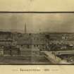
Invergordon, Royal Naval Dockyard


Naval Dockyard (First World War), Naval Dockyard (20th Century), Naval Dockyard (Second World War)
Site Name Invergordon, Royal Naval Dockyard
Classification Naval Dockyard (First World War), Naval Dockyard (20th Century), Naval Dockyard (Second World War)
Alternative Name(s) Cromarty Firth; Firth Of Cromarty
Canmore ID 107073
Site Number NH76NW 64
NGR NH 71016 68474
NGR Description Centred NH 71016 68474
Datum OSGB36 - NGR
Permalink http://canmore.org.uk/site/107073


- Council Highland
- Parish Rosskeen
- Former Region Highland
- Former District Ross And Cromarty
- Former County Ross And Cromarty
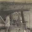
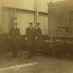
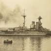
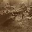
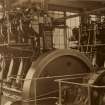
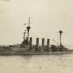
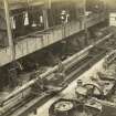
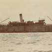
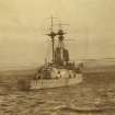
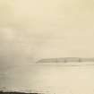
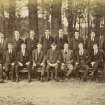
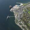
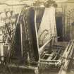
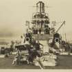
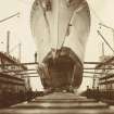
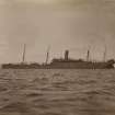
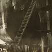
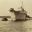
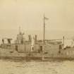
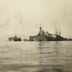
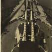
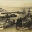
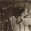
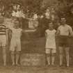
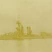
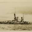
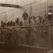
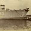
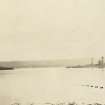
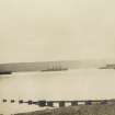
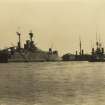
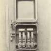
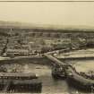
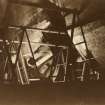
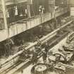
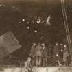
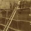
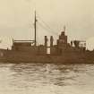
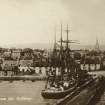
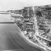
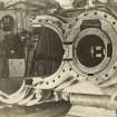
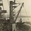
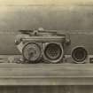
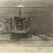
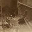
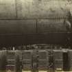
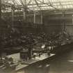
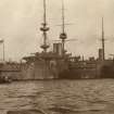
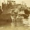
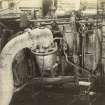
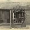
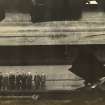
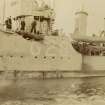
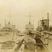
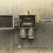
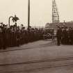
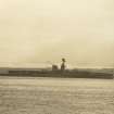
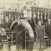
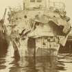
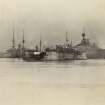
The Invergordon naval base took advantage of the the large sheltered roadstead provided by the Cromarty Firth. It began operating in 1913, with extensive dockside facilities, a vast complex of 41 fuel-oil storage tanks, and accommodation and other facilities for the many naval and civilian personnel. There was a large naval hospital. While most of the personnel lived it large hutments, 132 houses were built for dockyard personnel. The dockyard officers were provided with six substantial detached bungalows on the shore, while 126 semi-detached, single-story cottages were built for other staff - probably married senior craftsmen or married servicemen.
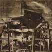
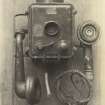
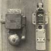
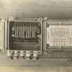
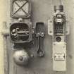
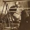
The design of defence of the base was put in hand in the same year. Three 9.2-inch guns (to tackle large enemy warships) and six 4-inch Quick Firing guns (to deal with smaller, faster-moving vessels) were emplaced on the headlands at the entrance to the Firth, the North and South Sutor (see NH86NW 9 and 11). The batteries were equipped with defence electric lights (powerful searchlights to illuminate targets for the guns at night). The mouth of the Firth was also obstructed by an anti-submarine boom, but its precise location is not known.
The naval base and the North and South Sutor batteries were defended from attack by land by complexes of firing trenches and barbed wire entanglements (see NH77SW 79).
There were large Army encampments nearby, mainly for training troops, but also to provide a defensive garrison for the base.
The dockyard was run down after the First World War and, although it continued in use through the Second World War as an oiling base, it never became as important a base again.
Information from HS/RCAHMS World War One Audit Project (GJB) 1 August 2013.
NH76NW 64.00 centred 71016 68474
NH76NW 64.01 NH 71155 68367 Pier (East)
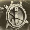
NH76NW 64.02 NH 71184 68278 Control Tower
NH76NW 64.03 NH 71100 68500 Main dockside facilities
NH76NW 64.04 NH 70825 68256 West pier
NH76NW 64.05 NH 70877 68311 Central Pier
NH76NW 64.06 NH 70377 68814 Military Camp
NH76NW 64.07 NH 71868 69350 Naval Hospital
NH76NW 64.08 NH Base housing esate
NH76NW 64.09 NH Accommodation area
NH76NW 64.10 NH Naval Hospital
For associated former Royal Naval Fuel Oil Tanks, see NH76NW 107
The Royal Naval Docks at Invergordon are visible on RAF vertical air photographs (CPE/Scot/UK184, 5287-5288, flown 9 Ocotber 1946), which show the pier and workshop arrangement at the end of WW II. The whole area has since been redeveloped and the W pier completely rebuilt. The E pier remains substantially the same, but a Lifeboat Station has been constructed between the two.
Information from RCAHMS (DE), October 2004.
Naval dockyard - not accessed.
CFA/MORA Coastal Assessment Survey 1998.
Project (March 2013 - September 2013)
A project to characterise the quantity and quality of the Scottish resource of known surviving remains of the First World War. Carried out in partnership between Historic Scotland and RCAHMS.
Field Visit (2015 - 2017)
NH 71016 68474 (Canmore ID: 107073) Invergordon was very important in WW1, when it formed a major naval repair and refueling base, with a large army camp. In WW2, it continued to be used by the navy for refuelling, but it was also used as an RAF seaplane training and rescue centre, and had army camps.
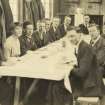
The wartime remains in Invergordon have been examined in two community projects: the first, looking at WW1 remains, in 2015 by ARCH with funding from the HLF; the second, looking at WW2 remains, in 2016/17 by Invergordon Museum (facilitated by ARCH) with funding from the HLF, Invergordon Community Council and a private donor. Participants investigated a range of historical sources, recorded surviving structures, and for WW2 shared and collected memories. A surprising amount remains, even of the WW1 structures. A trail leaflet of WW1 sites and features was produced (available from Invergordon Museum or the ARCH website), a book summarising the projects (available from the museum) and over 1000 records for the HER and Canmore. Participants also created a new display on the wartime years in Invergordon Museum. A large number of sites were looked at, from Rosskeen in the W to Saltburn in the east.
Archive: Invergordon Museum, Highland HER and NRHE
Website: www.archhighland.org.uk, www.invergordonmuseum. co.uk
Susan Kruse – Archaeology for Communities in the Highlands (ARCH)
(Source: DES, Volume 18)

